Death toll rises to 5 in wild California storms as officials assess damage, warn of flood risk
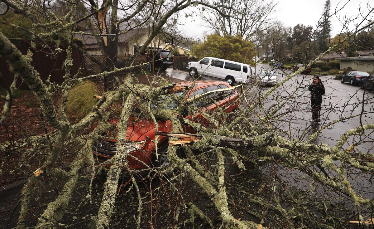
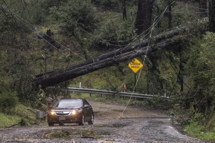
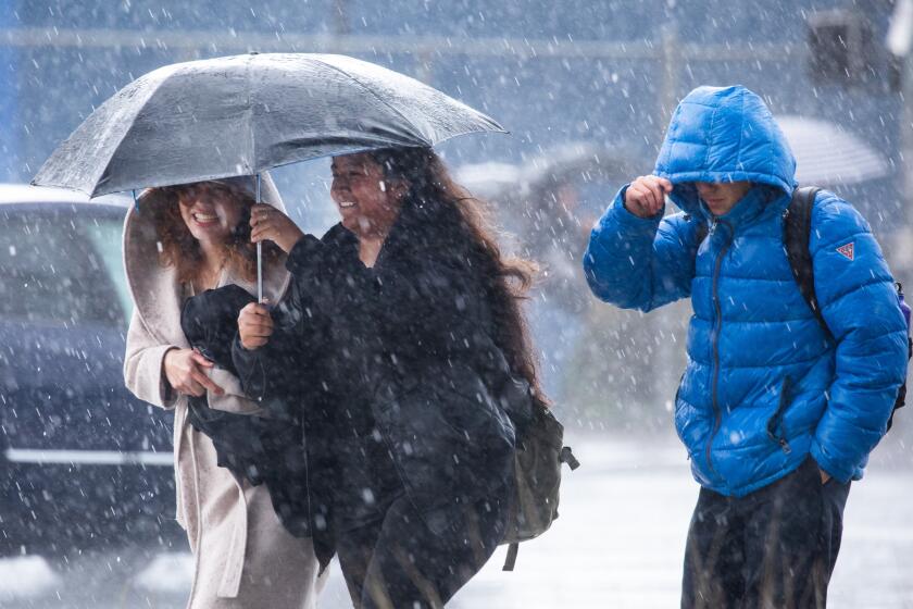
Heavy rain and damaging winds gradually subsided Wednesday as one of the wildest storms of the season made its exit from the Golden State, leaving at least five people dead and others critically injured as it felled trees, knocked out power, and threatened additional flooding in the Central Valley.
The San Francisco Bay Area and Central Valley suffered the most damage and loss. San Jose resident Jesus Cruz Diaz, 29, was killed after a tree fell on his vehicle in Portola Valley, according to the San Mateo County coroner’s office. Walnut resident Thomas Huster, 79, was killed when a large tree fell on his car in Walnut Creek, the Contra Costa County coroner’s office said.
In Oakland, a man who has not yet been identified was pronounced dead Tuesday night after a tree fell on the tent he was in near Lake Merritt. An exact cause of death has not yet been determined, but officials presume he died of either blunt force or suffocation.
Two people also died after being brought to Zuckerberg San Francisco General Hospital on Tuesday for treatment of injuries suffered in separate storm-related incidents, according to city officials. The office of the chief medical examiner identified them as Qiaoying Han, 55, of San Francisco County, and Ryan Taylor, 36, of Nevada’s Clark County.
Mayor London Breed said in a statement the deaths were “a grave reminder of how serious and dangerous this storm became.”
One person was killed in the storm that brought widespread rain, gusts that knocked glass out of skyscrapers and left tens of thousands without power.
The storm’s last gasp was expected to deliver more rain to the region through Wednesday night, but only about half an inch along the coast and valleys and an inch in the Santa Lucia and Santa Cruz mountains.
But as the remarkable “bomb cyclone” dissipated in the Bay Area, the Central Valley braced for more rain and potential flooding as the system tracked in its direction. A flood watch was in effect for a large swath of the region, spanning from Merced to Bakersfield and San Luis Obispo.
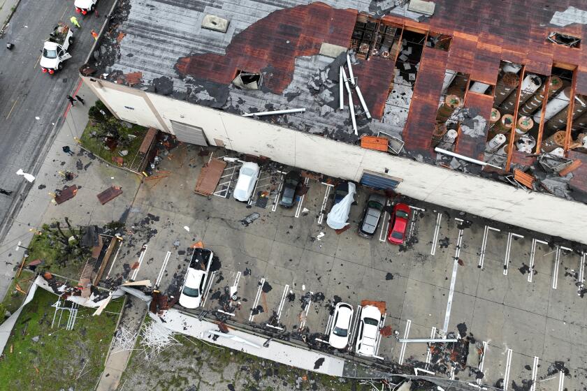
The wild weather also hit Southern California, where the National Weather Service confirmed two tornados in Montebello and Carpinteria that damaged multiple structures.
Thousands of people were under indefinite evacuation orders in Tulare County, where officials continued to monitor high levels on the Tule River and release water from Lake Success. Nearly 24,000 structures in the area were threatened, said Daniel Potter, spokesman for the California Department of Forestry and Fire Protection, which is assisting with emergency response in the area.
At least 760 homes and structures have been damaged, including seven that were completely destroyed, said Carrie Monteiro, spokeswoman for Tulare County’s Emergency Operations Center. Assessments are ongoing.
There is no estimated time frame for when evacuated residents will be able to return to their homes, and utility companies will also need to assess potential damage to water, sewer, electric systems and other infrastructure in the area, she added.
“We’re in for a long haul here in Tulare County,” she said.
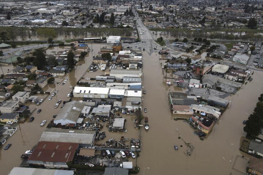
Images from space show the hard-hit California towns of Pajaro and Porterville before and after flooding caused by recent storms.
Weeks of wild weather have left few corners of California unscathed. Over the last month or so, Gov. Gavin Newsom has proclaimed a state of emergency in 43 of the state’s 58 counties.
“We’re continuing to mobilize an all-hands-on-deck response to protect Californians during this latest round of devastating storms,” Newsom said in a statement. “With communities from San Diego to Siskiyou County reeling from recent storms, the state is working closely with federal and local partners to provide immediate relief and support the ongoing recovery.”
As of Wednesday, 688 people were seeking refuge at emergency shelters in Calaveras, Humboldt, Kern, Mono, Monterey, San Bernardino, San Joaquin, Santa Cruz, Stanislaus and Tulare counties, according to the Governor’s Office of Emergency Services.
The peak of the storm saw about 244,000 Pacific Gas & Electric customers without power, the agency said, with about 90,000 still in the dark as of Wednesday afternoon. Initial assessments found 144 damaged poles and 73 damaged transformers.
In the Bay Area, the California Department of Transportation responded to “dozens and dozens” of reports of flooding, downed trees and power lines that snarled traffic, sometimes for hours as cars were stuck between two energized wires on the road, spokesman Kevin Drabinski said.
“We have five counties in our district,” he said of the area from Monterey to Santa Barbara. “There’s not one that wasn’t affected by flooding and downed trees — it’s just everywhere.”
Though weakened, the storm system could still deliver strong thunderstorms south of Fresno County, along with an additional half an inch of rain in the San Joaquin Valley and an inch in the Sierra Nevada foothills, said Bill South, a meteorologist with the weather service in Hanford. Two more feet of snow are possible at elevations above 6,000 feet.
The National Weather Service confirmed Wednesday that a tornado was responsible for tearing the roof from a building in Montebello.
South said the region’s flood watch had less to do with new precipitation totals than with “what happened leading up to this event.”
“Many of the rivers, streams and creeks are running at capacity right now, or just below capacity, so any additional rainfall today is going to cause additional flooding, or worsen ongoing flooding,” he said.
Tulare County officials estimated about 10,000 acres of the county were underwater due to the recent snowmelt and storms, he added. Videos shared by San Joaquin Valley news outlet SJV Water showed the low-lying area of Corcoran in nearby Kings County transformed into a “sea.”
More than 50 breaches had occurred along Tulare County’s 620 miles of waterways, said Monteiro, the emergency operations spokeswoman. Crews on Wednesday were continuing to secure large breaches and plug new ones.
However, “these are temporary stabilizations,” Monteiro said. “Once we get past this series of storms, and get past this immediate emergency response of stopping levee breaches or breaks, then we have to go back to all these areas and they have to be re-engineered.”
The heavily agricultural region was also anticipating crop damage. That includes field crops such as wheat and forage crops for cows, as well as citrus crops and pistachios, almonds, walnuts and other nuts, Monteiro said.
Officials were closely monitoring the Tule River, Kaweah River and Kings River watersheds, she added.
Though rainfall was expected to dissipate by Thursday, “we have over 200% of normal snowpack in our mountains, and that is going to melt as the seasons change warmer,” Monteiro said. “They’re balancing releasing water and managing the capacity of those reservoirs in preparation for rainstorms, but also in preparation for our snowmelt this summer.”
As Tuesday’s storm approached the Bay Area, the system developed two “eyes,” or areas of low pressure, that danced around each other and intensified dangerous winds.
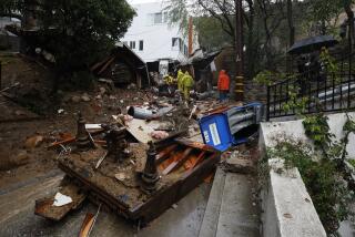
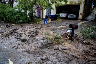
Southern California fared largely better than the Bay Area and Central Valley during the wild spring storm, although roadway flooding, debris flows and strong winds were reported.
On Wednesday, a landspout or tornado appeared in Montebello and ripped the roof of a building. The dark funnel cloud left enormous holes in the structure on South Vail Street and strewed debris around the area, damaging other buildings.
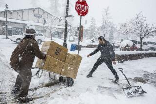
A winter storm warning was also in effect in the San Bernardino Mountains until 5 a.m. Thursday, where 60 mph wind gusts and up to 14 inches of fresh snow were possible. Blizzard conditions there earlier this month trapped scores of residents and resulted in more than a dozen deaths.
Recent snowfall totals were only a fraction of those seen during that historic event, however. From Tuesday to Wednesday morning, the San Bernardino County Department of Public Works recorded 10 inches of snow in Big Bear, 7 inches in Crestline, 11 inches in Lake Arrowhead, 14 inches in Running Springs, and 22 inches in Green Valley Lake. Crews will continue working during and after snowfall to clear roadways, officials said.
The rest of the week should be chilly and dry across much of California, forecasters said, though there is a chance for more rain to develop across the state as early as Monday.
But the strength of Tuesday’s storm caught even some meteorologist by surprise. The system brought hurricane-force winds as it developed two “eyes,” or areas of low pressure, that swirled around each other in what is known as the Fujiwhara effect.
“Wow. Even by the standards of what has turned out to be one of our most extraordinary winter seasons in a very long time, yesterday stands out,” the National Weather Service said.
More to Read
Start your day right
Sign up for Essential California for news, features and recommendations from the L.A. Times and beyond in your inbox six days a week.
You may occasionally receive promotional content from the Los Angeles Times.
