For Sunset, a new dawn
- Share via
Go east on storied Sunset Boulevard for a look at the changing nature of modern L.A. and a reawakening of pedestrian life.
Click the blue mile markers above — or use the arrows — to take Christopher Hawthorne's guided tour of key sites along Sunset Boulevard.
July 14, 2012
Conventional wisdom has it that the way to understand Sunset Boulevard, the most glamorous street in Los Angeles, is by following it from east to west.
That's how Sunset grew from its origins in the 1780s as a cattle trail branching out from the pueblo where L.A. was born. Even the boulevard's name suggests you're supposed to travel it that way, finishing up at the ocean just as the sun does.
So what's to be gained by heading in the opposite direction, looking at Sunset from west to east?
For starters, that route offers a way to explore an intriguing notion: that the key to deciphering contemporary Los Angeles is to focus not on growth and expansion, those building blocks of 20th century Southern California, but instead all the ways in which the city is doubling back on itself and getting denser.
And if you really want a gauge of 21st century Los Angeles, you'll have to look all the way to the eastern end of the boulevard, where Sunset becomes Cesar E. Chavez Avenue and — as it cuts through Boyle Heights — provides a surprising model for the L.A. boulevard of the future.
Boyle Heights seemed hopelessly distant as I began walking uphill from the ocean, where Pacific Coast Highway meets Sunset, heading past the two gas stations that mark the giant intersection like an accidental gateway. In less than a quarter-mile the sidewalk, already something of an afterthought, abruptly ended at a sign reading "Private Property."
That set the tone for the early part of the walk, which took me around a steady supply of blind curves, across the 405 freeway and to the edge of UCLA campus. There are crumbling sidewalks on boulevards all over Los Angeles, in every kind of neighborhood. But the western end of Sunset is the only major boulevard I know where the city seems to have abandoned the idea of a continuous sidewalk altogether.
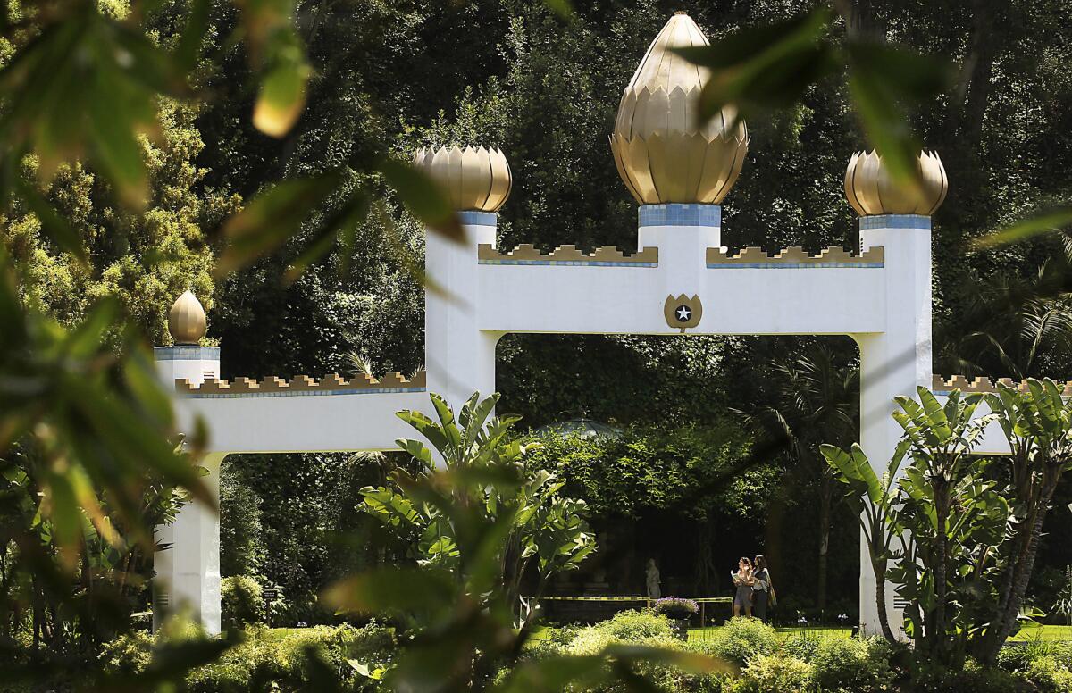
The Self-Realization Fellowship Lake Shrine Temple offers a verdant view along its Sunset Boulevard perch in Pacific Palisades. (Luis Sinco / Los Angeles Times) More photos
An oasis appeared quickly on the right: the Self-Realization Fellowship Lake Shrine Temple, where a shaded path wraps around a spring-fed lake. "Self-realization," of course, is that most Californian of phrases, with its faint tinge of narcissism.
But spirituality is not the only reason people visit the Lake Shrine, founded in 1950 by the Indian guru Paramahansa Yogananda. Like the Grove outdoor mall, except with more plants and no Apple Store, it happens to be an unusually nice place to be a pedestrian.
"We come here to walk and just take it all in," said Eric Runkle, who was helping his 88-year-old mother, Jenny Runkle, navigate the path.
Just east of the Lake Shrine, Sunset enters a long, winding stretch where the notion of the boulevard as public space seems faintly ridiculous. Close by are some of the great landmarks of modern L.A. architecture, houses by Craig Ellwood, Ray Kappe and Cliff May. But you'd never know that on the boulevard itself, which presents a nearly continuous wall of opaque hedges, thick bamboo stands and clusters of eucalyptus.
These green barriers get more imposing as you go east. By the time you get to Beverly Hills, the hedges are as tall as three-story buildings.
For a long time the western stretches of Sunset, with their private luxury and Hollywood glamour, were a powerful magnet in their own right.
Yet as early as the 1950s a nostalgic air hung over this part of the boulevard. Billy Wilder's brilliantly jaded "Sunset Blvd." sees not just the silent-film star Norma Desmond but also the very idea of her secluded Sunset Boulevard mansion, where time defiantly stands still, as a throwback. This "Rock of Ages" treats the big-hair metal bands and the Sunset Strip music scene of the '80s much the same way.
Along Sunset's long midsection, running from Beverly Hills through the western edge of Silver Lake, the footprint of the entertainment business, which once dominated the boulevard, continues to shrink. Thanks to the strong presence of its alumni among the ranks of Hollywood executives, Emerson College is building a dramatic 10-story, $110-million West Coast campus, by architect Thom Mayne, at Sunset and Gordon Street.
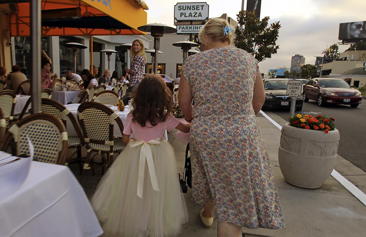
Sunset Plaza on the Strip is the place for window shopping, dressing up and dining. (Luis Sinco / Los Angeles Times) More photos
But Schwab's Pharmacy and places like it, buildings dedicated to advancing the notion of Sunset as a stage for finding individual stardom, are long gone. So are many of the movie studios that lined the boulevard a half-century ago, as well as the photography studios that sold head shots to generations of aspiring actors.
What has emerged to take their place, reflecting a city-wide trend, are types of developments largely immune to the rise of digital culture, which has proved so deadly to record and video-rental shops and bookstores. These hardier strains of L.A. architecture include restaurants, bars, public and charter schools, cheaply built wood-frame apartment buildings, bank branches and the ever-expanding infrastructure of hospitals and healthcare.
This part of Hollywood is also full of signs that Los Angeles, as it tries to redefine itself for a denser and less car-dependent future, is borrowing rather haphazardly from the architecture of other cities. The Bowery Bar and Bistro on Sunset just east of Vine and the nearby Delancey Pizzeria both market themselves as Manhattan-style outposts bringing a little urban grit to L.A.
Along with four other restaurants on Sunset, they are owned by George Abou-Daoud, the 37-year-old son of Egyptian immigrants who grew up in New York and came to Los Angeles in his mid-20s. Abou-Daoud, described by a food blogger as "the de facto mayor of Sunset in Hollywood," said that this stretch of the boulevard, forsaken a decade ago, continues to pick up momentum and a sense of pedestrian life, thanks in part to the Metro Red Line subway.
He described endless bureaucratic battles with the city's planning and building-safety departments. To get approval for sidewalk seating requires a process he called "beyond difficult."
"It's always been so surprising to me that in the city that has probably the best weather in the world, there isn't more outdoor seating for restaurants, pocket parks, public squares, etc.," he explained later in an email.
A more nimble example of L.A.'s rekindled interest in street design and the public sphere is the small Sunset Triangle Plaza, which opened in the heart of Silver Lake in early March..
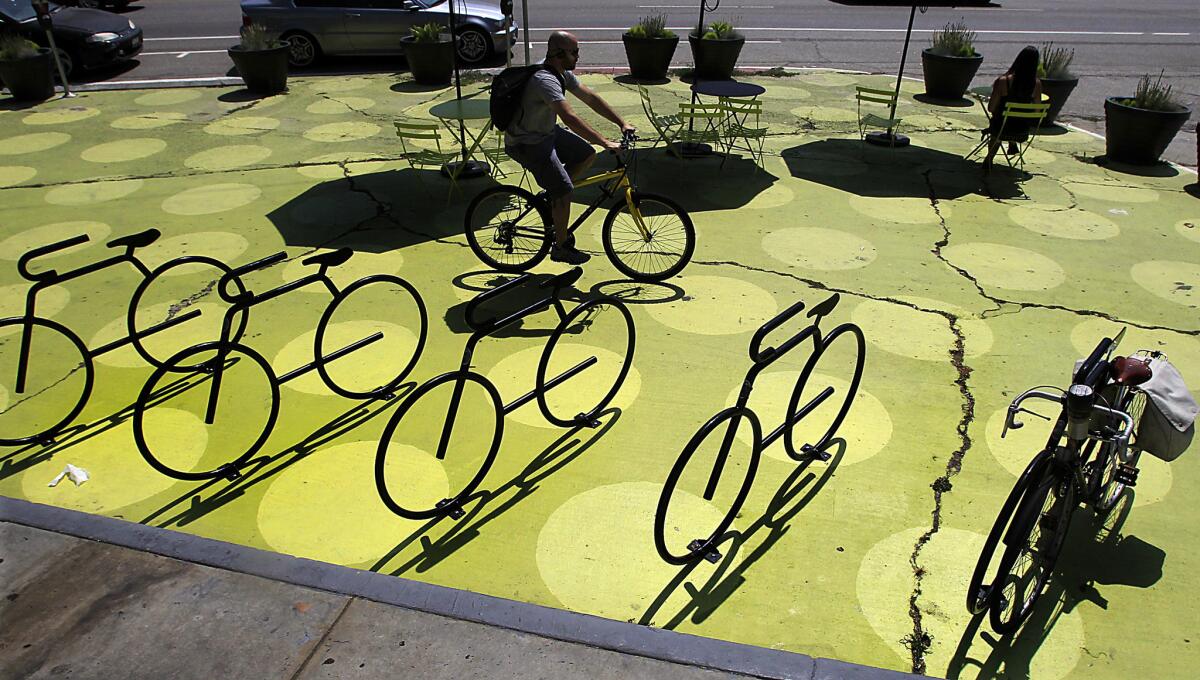
Silver Lake's Sunset Triangle Plaza provides a motor-free respite for the bustling block. (Luis Sinco / Los Angeles Times) More photos
It has cordoned off one block of Griffith Park Boulevard, where it meets Sunset, to car traffic. The street was already being closed twice a week for a farmers market. The city planning department and the L.A. County Department of Health spent a mere $25,000 to close it seven days a week, putting down plastic planters and painting the pavement a bright shade of green, with giant polka dots.
The design, by the L.A. firm Rios Clementi Hale, is a little rough around the edges. But that is part of the point: moving quickly to get the plaza open, the city didn't want to spend much time or money massaging the details. Officially the closure is temporary, and after a year officials will reevaluate the project.
"I wish it looked more permanent," Alissa Walker, a 34-year-old design writer who lives two blocks from Sunset, acknowledged as we sat under an umbrella at one of the plaza's small metal tables. "But the temporariness is what allowed it to take shape — that idea of doing it now and asking permission later."
Walker is a dedicated pedestrian who doesn't own a car and casually uses the word "walkshed" to refer to the area in her neighborhood that she can reach easily on foot. She says the plaza is emblematic of a wider shift in the city.
"When I go to parties, people always say, 'Where's your car?' And I'll say, 'I walked here.' And it used to be like, 'Oh, my God, you're crazy! It's not safe!' But now people will say 'That's cool,' or 'I walk a lot too.' In the last three or four years the level of surprise has really dialed down."
On the edge of downtown, just after it passes over the 110 Freeway, Sunset becomes Cesar E. Chavez Avenue before crossing the Los Angeles River and skirting the northern edge of Union Station. Stretches of the boulevard with three names — Sunset, Macy Street and Brooklyn Avenue — were subsumed by the new Cesar E. Chavez Avenue, christened in 1994, the year after the civil-rights leader's death.
In the 1920s and '30s, Brooklyn Avenue and the Boyle Heights neighborhood it cuts through formed a center of Jewish life in Los Angeles. Canter's Deli was there, and the area had more than 30 synagogues. Some were in small houses or storefronts, but in 1923 a genuine architectural landmark was built, the Breed Street Shul, a half-block south of Brooklyn.
The synagogue was designed in an imposing neo-Byzantine style by A.M. Edelman, also the architect of the better-known Wilshire Boulevard Temple. The late architectural photographer Julius Shulman, who grew up on nearby Cummings Street, had his bar mitzvah there the year it opened.
Although some locals still refer to this part of Cesar Chavez as "Brooklyn Avenue," Boyle Heights is now more than 94% Latino. On the far western end of Sunset, by contrast, Pacific Palisades is 89% Anglo, with a median income, $168,000, that is five times higher.
Shaded by huge ficus trees and crowded with pedestrians, the stretch of Cesar Chavez just east of the 5 Freeway upends a few persistent stereotypes about Los Angeles: that nobody walks, that everybody lives in a single-family house, works in the movie business and spends most of his time cocooned in an air-conditioned car, shouting Ari Gold-style into his cellphone earpieces.
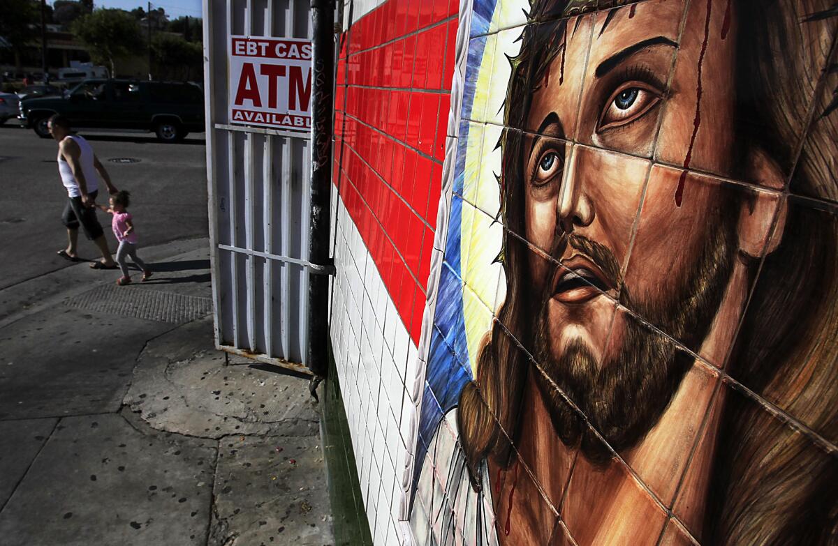
A meat market on the 3400 block of Cesar Chavez in Boyle Heights is among the many small shops that cater to residents along a highly walkable stretch. (Luis Sinco / Los Angeles Times) More photos
The businesses here mostly cater to local residents, announcing themselves with hand-painted signs in English and Spanish and selling small items — children's clothes, figurines of Catholic saints — that their customers can easily carry home. The two-story brick buildings that form a consistent street wall on both sides of the street look much as they did in the 1920s. Very few were knocked down to make way for the architecture of the post-war city, with its drive-throughs, gas stations and supermarkets marooned in massive parking lots.
Much of the street's success can be credited to neglect from the larger city, as investment in the post-war era went elsewhere. But Cesar Chavez Avenue hasn't just survived: It has emerged as a model for other neighborhoods eager to make their major thoroughfares friendlier to pedestrians, cyclists and local business. It has all the urban-design amenities the average L.A. boulevard is desperately missing.
One hot afternoon I walked the far eastern end of Cesar Chavez with John Arroyo, an urban planner who grew up in the neighborhood and still lives here. Now 31, he graduated from USC before earning a master's degree in planning from MIT.
He said the neighborhood has long reflected the influence of "Latino Urbanism," a term coined by the L.A. planner James Rojas. As Rojas has written, immigrants from Latin America have slowly been transforming "the auto-oriented built form" of Los Angeles into a series of "pedestrian-oriented places."
Cultural influence has always been a two-way street along Cesar Chavez, of course, with American idioms seeping into Latino culture even as the reverse is true. When Arroyo was in high school in the late 1990s he went to countless backyard parties where his friends played the brooding pop songs of the British singer Morrissey.
"I don't know quite how it happened," he said with a shrug, "but all of a sudden there were Morrissey cover bands everywhere."
Near the end of our walk he took me to see the Evergreen Cemetery, a rolling 67-acre piece of greenery in a neighborhood that is lacking, like so many parts of Los Angeles, in parks. Over time, neighborhood residents adopted the cemetery as a quasi-public space, walking or jogging through it or along its perimeter.
In 2003 the city added a 5-foot-wide path of pink-red rubber on the sidewalk along the outside of the cemetery. The path is full morning and night with joggers, walkers and parents pushing strollers. It's also become a social center in the neighborhood, a spot where people come to trade gossip and catch up with friends.
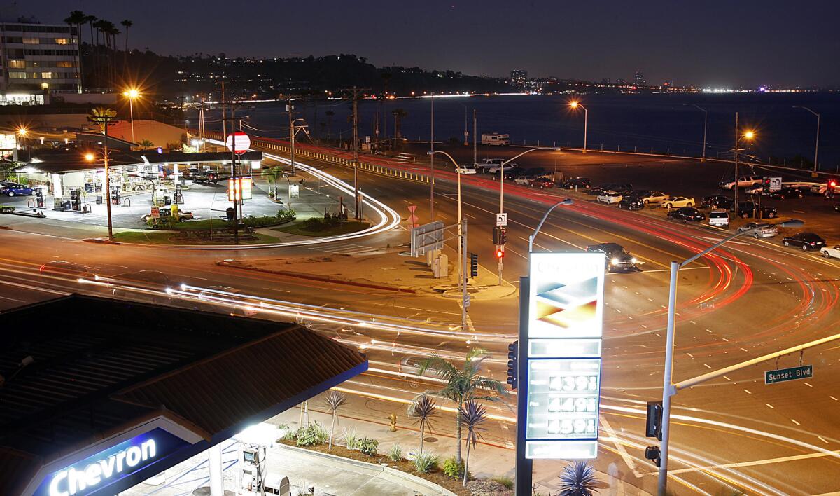
Sunset Boulevard meets the Pacific Coast Highway at its western terminus. (Luis Sinco / Los Angeles Times) More photos
L.A.'s successful pedestrian enclaves — the Grove and the Lake Shrine among them — have typically been privately operated. And they've been destinations: People drive their cars there in order to find a protected place to walk.
The Sunset Triangle Plaza and Boyle Heights suggest the emergence in L.A. of a different model: public spaces for walking, designed in a cost-effective if sometimes prosaic way, meant to serve a neighborhood crowd.
Sunset Boulevard has long operated as a zipper or seam across the length of the city, connecting the foothills to the flat expanse of the L.A. basin. But what the boulevard does most dramatically now is provide a bridge — as it moves from west to east — linking L.A.'s past to its emerging future..
Walking east on Sunset, turning my back on the beach, I was not only trudging uphill but also pushing against the weight of history. The notion of the ocean as frontier is so ingrained in the basic psyche of this city that to resist it feels like some kind of betrayal.
The cultural center of gravity in Los Angeles has been moving east for years. Young artists, architects, musicians and writers now tend to settle in Silver Lake, Highland Park or downtown. Much of Boyle Heights feels like a place where the contemporary definition of Los Angeles — young, Latino and increasingly transit-friendly — is being hashed out on a daily basis.
For decades, searching for a metaphor to define Sunset Boulevard, writers have described it as a river running west and feeding into the Pacific. But the river flows the other direction now.
Explore Sunset Boulevard on an interactive tour with Christopher Hawthorne.
christopher.hawthorne@latimes.com
Graphic credits: Lorena Iñiguez Elebee, Julie Sheer | Programming: Anthony Pesce
Sources: ESRI, TeleAtlas
The biggest entertainment stories
Get our big stories about Hollywood, film, television, music, arts, culture and more right in your inbox as soon as they publish.
You may occasionally receive promotional content from the Los Angeles Times.

