Earthquake fault runs through Rodeo Drive and Beverly Hills’ shopping district, California geologists say
- Share via
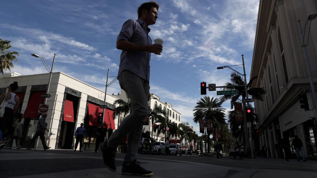
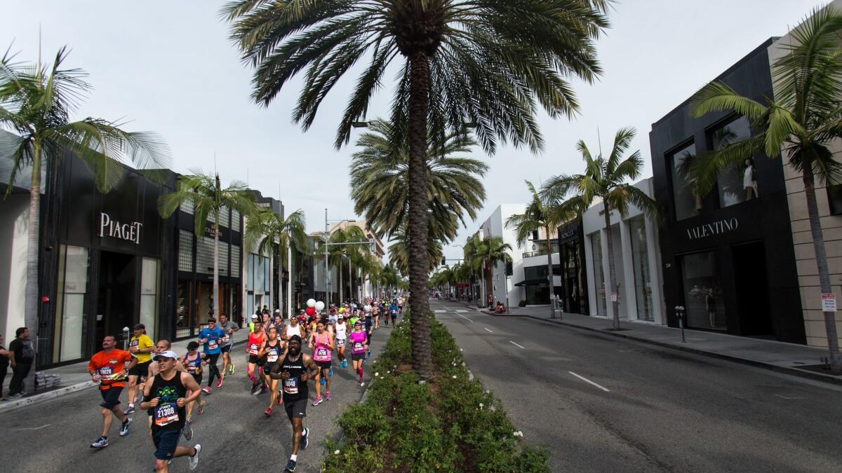
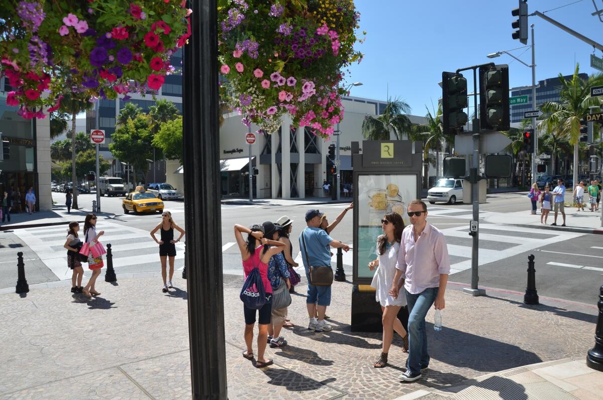
New data from state geologists show that an earthquake fault runs below Rodeo Drive and Beverly Hills’ shopping district, heightening the known seismic risk in an area famous for Cartier, Gucci, Prada and other luxury brands.
The California Geological Survey’s final map has the Santa Monica fault zone cutting through the so-called Golden Triangle, running between Santa Monica and Wilshire boulevards.
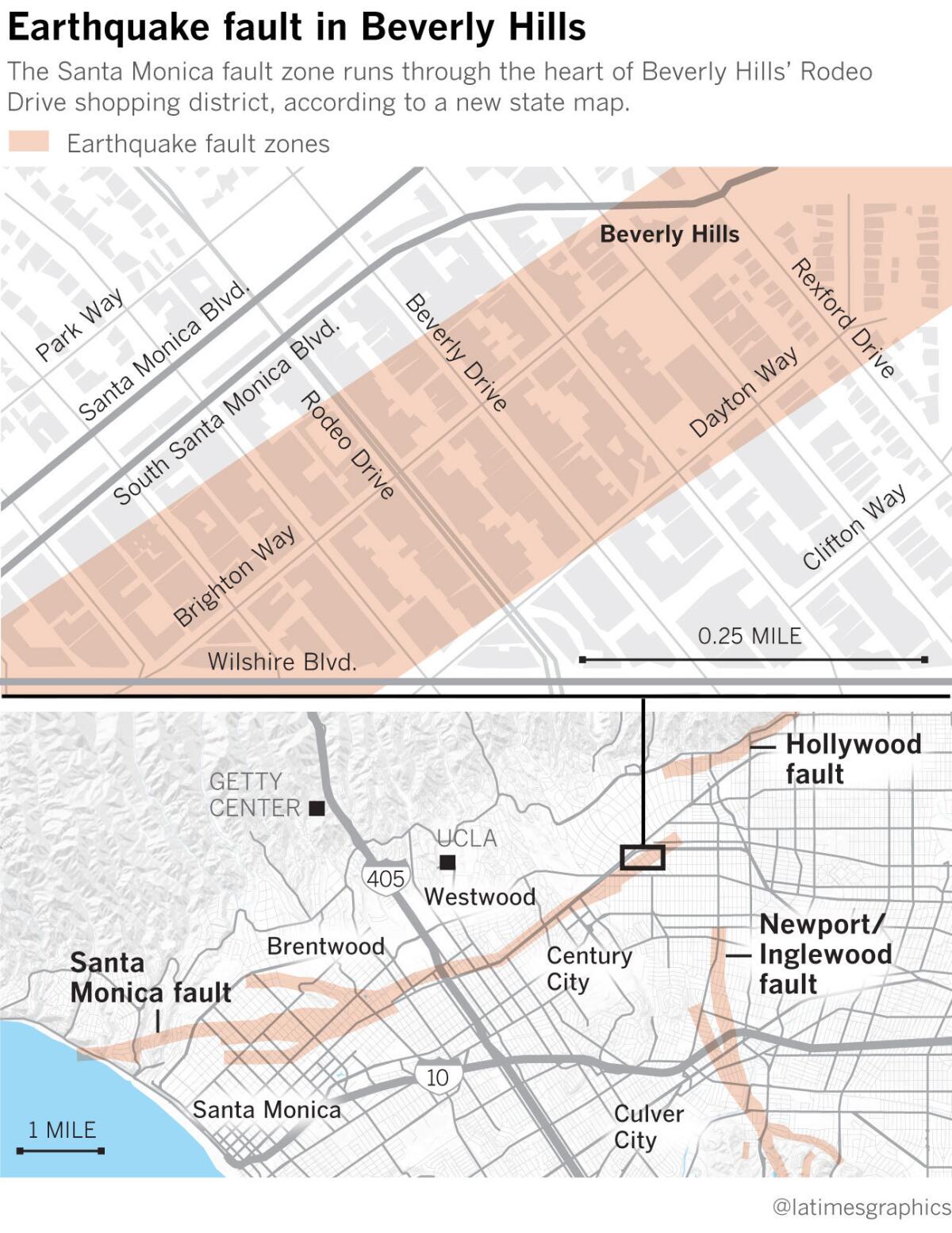
The new map is a change from a draft version released last year that showed the fault zone ending on the western edge of Beverly Hills, near the corner of Wilshire and Santa Monica boulevards. Based on more information, the state now says the fault zone extends a mile farther northeast, through Beverly Hills’ central district and into the city’s civic center area.
Faults runs through Westside
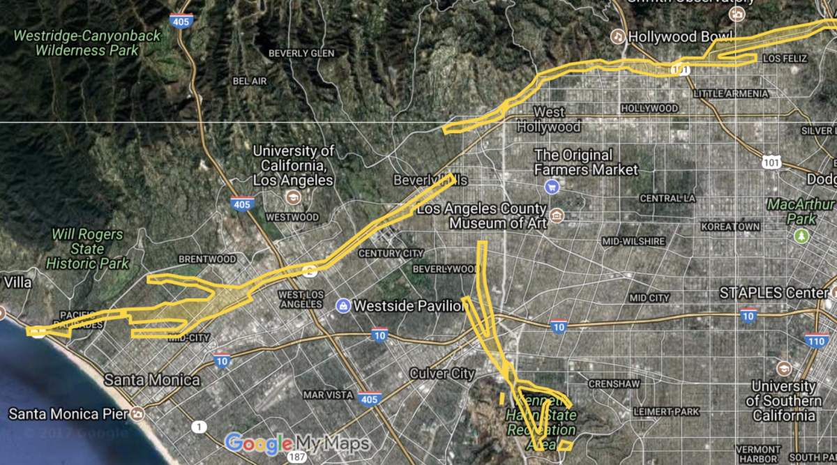
The Santa Monica is one of several faults running through highly populated areas of Southern California to generate interest and concern from seismic experts and government officials. The fault zone cuts through the heart of the Westside, straddling or paralleling Santa Monica Boulevard through Century City and Westwood before veering due west, with segments running into Brentwood, Santa Monica and Pacific Palisades.
It’s capable of producing a magnitude 7 earthquake. Experts believe the most recent major earthquake on the Santa Monica fault occurred 1,000 to 3,000 years ago.
Over the last few years, the state has stepped up drawing official so-called Alquist-Priolo Earthquake Fault Zones across California, a required first step before seismic safety laws can apply to areas.
Areas with fault zones face limits on development. Owners of properties in these zones are obligated to hire geologists to ensure that new buildings or major renovation projects aren’t located directly on an active fault line.
The Beverly Hills shopping district has some of the priciest retail real estate in the nation, but the area is already fairly built out with a mix of shops and mid-rise office buildings. It’s unclear whether there are any major developments that haven’t yet been approved by local governments that are on the drawing board in the fault zone.
“We’re all afraid of earthquakes,” said Norbert Wabnig, who runs the Cheese Store of Beverly Hills. “To know that there’s [a fault line] close to us, that’s even scarier.”
Buildings directly on top of faults can suffer major damage and destruction, as one side of the building moves away from the other.
During the 1971 Sylmar and 2014 Napa earthquakes, homes built atop a fault suffered major damage as their foundations were torn apart, while homes just a few hundred feet away suffered far less damage, said Tim Dawson, senior engineering geologist with the California Geological Survey.
Larger buildings straddling a fault could be more vulnerable and completely collapse, Dawson said.
“We don’t want to put essential facilities on top of active faults, such as fire stations, hospitals, schools,” he said.
Along Santa Monica Boulevard
The Santa Monica earthquake fault zone is generally 1,000 feet wide, and runs west of Beverly Hills for more than eight miles, with the zone running through the Westfield Century City mall and the Mormon temple.
Earthquake faults can change land in ways that made them appealing generations ago for developers who were unaware of the seismic risk.
It was past earthquakes that made Santa Monica Boulevard a perfect spot for a major roadway and the Red Car trolley line — a flat area just below a hillside, Dawson said.
Prehistoric earthquakes threw up the north side of Santa Monica Boulevard, Dawson said, forming the dramatic hillside perch that the Mormon temple now calls home and moving it west toward the ocean. The area to the south of the boulevard is getting relatively lower and has also been shifting to the east.
California law prohibits new development on top of fault lines, but it does not require existing buildings in the zones to be altered.
State scientists have various degrees of certainty about the fault’s location. Some drawn paths are considered accurate based on detailed geology investigations on specific plots of land to identify a fault. Other sections of the fault are considered approximately located.
Still other parts of the fault’s path are inferred, in which geologists connect the dots between two points along the fault and “we see a fault at point A, and there’s good evidence there’s a fault at point B,” Dawson said. “Faults are typically continuous features — they don’t typically stop.”
State officials said the part of the Santa Monica fault they now believe runs through Beverly Hills’ shopping district is inferred based on a geology investigation done in preparation for the Metro subway and on geology data east of the civic center.
Beverly Hills spokeswoman Therese Kosterman said the city is aware of the new Santa Monica fault map issued by the state. “The current map has significant revisions from the earlier draft map that the city had commented on and so we are currently in the process of evaluating the changes,” Kosterman said in an email.
More study over the coming years and decades will help improve maps of the fault. One research technique state geologists hope to pursue with the U.S. Geological Survey is to send waves of energy underground, such as through a hammer, and then see how they move through the earth. If a fault is there, the energy will move in a specific way, and studying it will help scientists better map the fault.
Faults change development
The threat of destruction on top of faults is such a risk that some agencies have taken steps to vacate or demolish buildings directly on top of them. San Bernardino Valley College demolished seven buildings along the San Jacinto fault in the 2000s; in 1991, Los Angeles Southwest College tore down two that sat on top of the Newport-Inglewood fault.
In the San Francisco Bay Area, officials in Hayward ordered its historic City Hall vacated because the Hayward fault was slowly tearing it apart. Fremont demolished its City Hall after geologists said it was on top of the same fault.
In areas that were developed after fault map studies were published, developers have avoided building on top of the fault, placing buildings away from fault lines while still building in the fault zone.
Developers in Signal Hill took care to build homes away from the Newport-Inglewood fault; parks and trails were instead placed where the fault could more safely split in two.
In Huntington Beach, after the discovery of a fault underneath the northern portion of the Seacliff Village shopping center, developers demolished the center and rebuilt it, placing a parking lot directly on top of the fault.
Sometimes, though, it can be impossible to transform a small plot of land bisected by a fault line into a new development.
The release of this fault map does not mean scientists are done. Geologists don’t know where the Santa Monica fault ends.
“It’s possible it connects up with the Hollywood fault, and that’s what we’d really like to answer,” Dawson said. The Hollywood fault runs along the Sunset Strip in West Hollywood and through the heart of Hollywood.
Connections to other faults
The Santa Monica fault — along with offshore faults as well as the Hollywood fault and the Raymond fault, which extends east into Pasadena and the San Gabriel Valley — is part of a major tectonic boundary in Southern California between the Santa Monica Mountains to the north and the Los Angeles Basin to the south. It is possible that the Santa Monica, Hollywood and Raymond faults could rupture nearly simultaneously in the same earthquake.
If there’s one silver lining, it is that the Santa Monica fault and its cousins, the Hollywood and the Raymond, move far more slowly than California’s most famous fault, the San Andreas.
One side of the San Andreas is moving past the other at a rate of 25 to 34 millimeters a year, far faster than the Santa Monica-Hollywood-Raymond system, which is moving around 1 to 2 millimeters a year.
This means that while the southern San Andreas fault is expected to have large earthquakes every 100 to 200 years or so, thousands of years could pass between large earthquakes on the Santa Monica fault.
State mapping of earthquake faults had slowed to a crawl for more than two decades because of budget cuts. But the pace accelerated after Gov. Jerry Brown and California lawmakers in 2014 approved a sharp increase in funding.
The funding change came after the Los Angeles Times published articles examining the impact of the failure to draw the maps, which affected public safety.
A Times analysis in 2013 found that the cities of Los Angeles and Santa Monica in the previous decade had approved more than a dozen construction projects on or near two well-known faults without requiring seismic studies to determine whether the buildings could be destroyed in an earthquake.
In 2015, Los Angeles Mayor Eric Garcetti said the city had begun more extensive scrutiny of new developments proposed near earthquake faults on the Westside, in the South Bay and in northeast L.A.
Los Angeles Times staff writer Roger Vincent contributed to this report.
Twitter: @ronlin
raoul.ranoa@latimes.com
Twitter: @ranoa
UPDATES:
3:05 p.m.: This article was updated with context on the recent acceleration of earthquake fault mapping by California state geologists.
This article was originally published at 5 a.m.
Sign up for Essential California
The most important California stories and recommendations in your inbox every morning.
You may occasionally receive promotional content from the Los Angeles Times.


