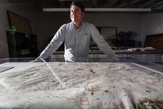
Stanford’s historic maps of California as an island are online
The maps, of course, depict a mistake: They show California as an island off the coast of North America, reflecting the beliefs of some explorers and cartographers from the 17th and 18th centuries. But the maps’ beauty and oddity had attracted the attention of Glen McLaughlin, a Northern California businessman who began buying and collecting hundreds of them over the last four decades.
McLaughlin last year turned over his unusual collection to Stanford University’s Branner Earth Sciences Library and Map Collections in an arrangement that was part sale and part donation. And now the public can see and download 731 of the maps thanks to a digitizing project at the school.
The online repository is expected to attract viewers interested in early California history, or at least the imaginations of European explorers of the region. Spurred in part by fantastical descriptions in an early 16th century novel, Spanish travelers originally searched for an island supposedly populated by cannibalistic Amazons with plentiful jewels and gold.
“The island of imagination won over terrestrial reality and resulted in some of the most beautiful maps ever produced,” according to an essay on the Stanford library website.
While the island theory was refuted two centuries later, the sense of California of being an island of freedom and innovation never died, McLaughlin told The Times last year. “There is enormous tolerance for different points of view. So inventors, who might be called kooks or nuts someplace else, were embraced here and encouraged,” he said.
ALSO:
Power outages ordered as Clover fire rages in Shasta County
Marion ‘Suge’ Knight arrested after traffic stop near Beverly Hills
Transgender teen nominated for homecoming queen in Huntington Beach
Twitter: @larrygordonlat
More to Read
Sign up for Essential California
The most important California stories and recommendations in your inbox every morning.
You may occasionally receive promotional content from the Los Angeles Times.


