‘Significant’ storm expected to bring steady rain to Southern California this week
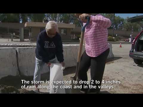
Rainfall rates could exceed a half-inch per hour, which is enough to cause mudflows and flash flooding.
A storm system moving toward Southern California will bring a “long period” of steady rain across the region this week and could trigger debris flows in recent burn areas, forecasters said.
The storm is expected to drop 2 to 4 inches of rain along the coast and in the valleys in Los Angeles, Ventura and Santa Barbara counties, and 4 to 6 inches in the mountains between Tuesday afternoon and Thursday morning, said Todd Hall, a meteorologist with the National Weather Service in Oxnard. South-facing slopes could see up to 8 inches in some areas.
“It’s a type of system we’re not used to in Southern California,” Hall said, warning commuters about potential roadway flooding and traffic impacts in Malibu and Topanga Canyon. “I think some of our infrastructure will struggle to handle” it.
Rainfall rates could exceed a half-inch per hour, which is enough to cause mudflows and flash flooding.
“It could hit the Thomas burn area. We could see it in the La Tuna” burn area as well, Hall said.
Authorities in Santa Barbara County are on alert and warned residents below the Thomas, Sherpa, Whittier and Alamo fires to be ready to evacuate this week.
Rob Lewin, director of the Santa Barbara County Office of Emergency Management, said in a statement that this week’s deluge will be the “most powerful storm” since Jan. 9, when mudslides swept through Montecito, killing 21 people and destroying homes.
Parts of the Southland last week experienced rain-related complications. A mudslide closed Topanga Canyon Boulevard through the Santa Monica Mountains from Thursday through Saturday.
alene.tchekmedyian@latimes.com
Twitter: @AleneTchek
More to Read
Sign up for Essential California
The most important California stories and recommendations in your inbox every morning.
You may occasionally receive promotional content from the Los Angeles Times.
