NASA makes second attempt to launch CO2-measuring satellite
- Share via
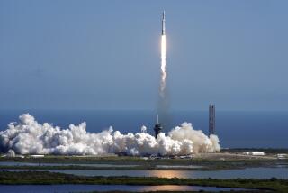
Five years after a launch malfunction destroyed its twin, NASA’s Orbiting Carbon Observatory-2 is slated to blast off from the California coast Tuesday, becoming the nation’s first satellite to exclusively monitor the greenhouse gas.
The mission of the $465-million spacecraft is to measure and map carbon dioxide levels in the atmosphere and provide scientists with a better understanding of how the Earth’s oceans, soils and forests absorb CO2, and whether that ability is changing.
“We really don’t have a lot of data right now to understand the uptake of carbon by these terrestrial ecosystems,” said OCO-2 science team member Paul Wennberg, a professor of atmospheric chemistry at the California Institute of Technology.
The satellite’s nickname, OCO, describes the composition of a carbon dioxode molecule -- two oxygen atoms flanking a single carbon atom in linear fashion.
The satellite’s launch is scheduled for 2:56 a.m. Tuesday at Vandenberg Air Force Base, near Buellton.
An earlier version of the satellite was lost on Feb. 24, 2009, when it failed to separate from the launch vehicle (an Orbital Taurus XL rocket) and burned up on reentry. The cost of that failed mission was $209 million, according to a mishap investigation.
OCO-2 is a near duplicate copy of the first satellite, but will be lifted into orbit on an entirely different platform -- a ULA (United Launch Alliance) Delta II 7320-10C rocket.
Carbon dioxide is a greenhouse gas that occurs both from natural processes, such as forest fires, and from human industrial activities, such as the burning of fossil fuels.
Like water vapor, C02 traps heat energy that would otherwise rise from the planet’s surface and escape into space, and researchers say CO2 concentrations today are the highest they’ve been in the last million years.
While many scientists say elevated CO2 concentrations are increasing the Earth’s average surface temperature, researchers have also observed that the planet itself has removed roughly half the man-made CO2 from the atmosphere.
“We don’t understand entirely what is the trend in the ability to take up CO2,” Wennberg said. “For example, do we expect that as the Arctic warms that the boreal forest, the high-latitude forest, will become a larger source or sink of carbon dioxide? These are the types of questions we are going to be addressing.”
The satellite will measure atmospheric CO2 with spectrometers, devices that divide light into its component wavelengths, or colors, the way a prism does.
As sunlight travels down through Earth’s atmosphere, bounces off its surface and then travels back up through the atmosphere toward space, CO2 molecules will absorb some of this light at specific wavelengths.
With the spectrometers, scientists will recognize CO2 molecules as a specific pattern of dark areas. The more intense these dark areas are, the more CO2 molecules there are.
“It measures the average amount of CO2 above a place on Earth, which is different from almost all other measurements of CO2, which are measurements in a small volume of air,” Wennberg said.
Follow @montemorin for science news


