Storm Plants Itself Over Basin
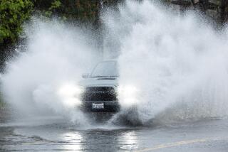
The first El Nino-related storm of the season lumbered in from the Pacific on Friday, roiling surf, unleashing mudslides and raising the demand for sandbags across Southern California.
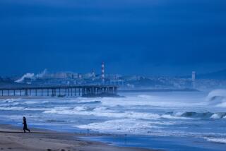
The storm, which is expected to last until Sunday morning, sent eight-foot waves roaring to the shore in Malibu. Winds across the region gusted to 50 mph. Scattered power outages affecting about 3,000 homes were reported throughout the Southland, including one that left a small section of Glendale without power.
By late Friday, more than three inches had fallen in Santa Barbara and in portions of Ventura County. In Los Angeles County, more than 2 1/2 inches had drenched Woodland Hills. The brunt of the storm was expected to hit central Los Angeles and continue south to Orange County early today. By 10 p.m. Friday, only about 0.3 of an inch had fallen at the Los Angeles Civic Center.
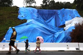
A mudslide forced the temporary closure of California 150 between Santa Paula and Ojai, and by late afternoon, authorities had closed off access to the Sepulveda Basin Recreation Area in the San Fernando Valley as the level of the Los Angeles River at the Sepulveda Dam reached 12 feet.
The storm had been anticipated since midweek, and in most areas residents were prepared. In flood-prone areas, homeowners busily filled sandbags supplied by emergency agencies, and swift water rescue teams went on standby in Orange, Los Angeles and Santa Barbara counties.
In the Valley, crews from the U.S. Army Corps of Engineers worked feverishly to finish clearing brush and debris from several flood control channels. At Gladstone’s restaurant in Malibu and at Santa Monica State Beach, bulldozers nudged boulders and sand into protective berms.
In Pasadena, officials announced that today’s mechanical testing of the Rose Parade floats, usually an outdoor event, would be moved indoors. Metrolink postponed until Dec. 19 the “Holiday Toy Express,” a special train that was to move across the region today collecting toys for needy children.
The Los Angeles Roman Catholic Archdiocese canceled Sunday’s 67th annual procession for Our Lady of Guadalupe and moved the Mass from East Los Angeles Community College Stadium to Our Lady of Guadalupe Church.
In Castaic, preparations were so intense that an inmate at the Peter Pitchess Detention Center used them as an opportunity to escape. Los Angeles County Sheriff’s Deputy Angie Prewett said that David Slager, 23, serving time for spousal assault, was assigned to a team filling sandbags about 2 p.m. when he walked away from his job at the center’s South Facility.
Meteorologists said the storm, which hit the coast near Point Conception and moved south and east, could eventually drop up to four inches of rain on parts of the Los Angeles Basin. Flash flood watches were issued for Santa Barbara, San Bernardino, Los Angeles and Ventura counties.
Meanwhile, in the mountains, the storm was expected to bring between 2 and 5 inches of snow. Meteorologist Wes Etheredge of WeatherData Inc. predicted that the snow line would fall to about 5,500 feet.
Etheredge said the skies should clear up Sunday morning, with lingering showers and clouds throughout the day. Temperatures are expected to remain in the upper 50s and mid-60s through the region’s low-lying areas, and in the 30s and 40s in the mountains.
Although it was viewed by many meteorologists as the first true El Nino-related storm of the season, Friday’s weather looked to most Southern Californians like ordinary rain. Etheredge said the much-discussed meteorological phenomenon is too broad to be seen in the context of any single storm. Rather, he said, “it is seasonal and climatological, affecting things over a two- or three-month span.”
But Nino or no, the weather was definitely wet, and got wetter as it moved across the region. In Ventura County, where the storm hit first, a flood alert had been issued by midafternoon, and residents in Oxnard’s El Rio neighborhood were stockpiling sandbags.
Later, the storm moved south into the Valley and other parts of Los Angeles County.
Mona Lee Goss, a spokeswoman for the Army Corps of Engineers, said the gate closures to the Sepulveda Basin were just precautionary. However, they have been routine since 1992, when rapidly rising flood waters trapped several cars on streets in the basin. The drivers, who sought refuge on their auto roofs, had to be rescued by helicopters.
The corps is also in the process of clearing about 35 miles of flood control channels that are its responsibility. Barring any long periods of rain, the project should be completed in the next few weeks, Goss said.
Fire Department officials were inundated Friday with calls from residents requesting information on where to obtain sandbags.
The Los Angeles County Fire Department issued El Nino preparedness tips for residents living in flood-prone areas.
“For months we have been telling residents to get prepared for the heavy rains, but many of them wait until the rains come and start scrambling,” said Inspector Henry Rodriguez, a department spokesman. He advised residents to stay away from rivers, flood control channels, storm drains and the like. “One second a channel can be empty and [then], without warning, can become a raging river during a rainstorm.”
People who live in flood-prone areas should develop plans to escape to higher ground, he said.
Rodriguez also reminded residents that swift-moving shallow water can be just as dangerous as deeper, raging waters.
Times staff writer Shawn Hubler and correspondent Claire Vitucci contributed to this story.
More to Read
Sign up for Essential California
The most important California stories and recommendations in your inbox every morning.
You may occasionally receive promotional content from the Los Angeles Times.


