Trails Are Tough, but Scenery’s Worth It
“The map is not the territory,” wise explorers counsel. That adage seems to apply to the Simi Hills. They appear as little more than narrow bands between suburbs on a map, but on the ground present some challenging territory to hike.
The Simi Hills escape most hikers’ attention because they are both literally and figuratively overshadowed by two other regional ranges located on this side of the Southland. The nearby Santa Susana Mountains are considerably rounder and taller than the Simi Hills. And the nearby Santa Monica Mountains have a high public profile due to associations with Malibu, movie stars and movie locations, as well as the range’s national parkland status.
These comparisons aside, the Simi Hills have a distinct identity when viewed up close. Somehow the sky-scraping sedimentary rock formations seem all the more awesome towering over flatland neighborhoods. The reddish-orange sandstone outcroppings of the Simi Hills, dating from the Tertiary and Mesozoic periods 60 to 80 million years ago, form a dramatic backdrop. It’s easy to see why these rugged hills were a popular setting for western movies.
China Flat Trail is an excellent (but not easy) introduction to the Simi Hills. It leads to China Flat, perched on the wild west side of the National Park Service’s Cheeseboro Canyon site. The trail’s return loop contours high over the shoulder of 2,403-foot Simi Peak, the highest in the Simi Hills.
Ambitious hikers will enjoy China Flat Trail as a backdoor entry along the ridge crest to Cheeseboro and Palo Comado canyons, part of the Santa Monica Mountains National Recreation Area. Expect a 10- or 12-mile hike (or more) as well as a measure of solitude on this lightly traveled route.
China Flat Trail is a bit of a misnomer; the trail is anything but flat. Still, it is a most enjoyable loop, requiring only a one-block neighborhood stroll to connect trail’s end with trail head.
Directions to the trail head: From the Ventura Freeway (U.S. 101) in Westlake Village, exit on Lindero Canyon Road and head north four miles. A few blocks from the trail head, Lindero Canyon Road bends east. Look for the signed trail head on the left (north) side of the road between King James Court and Wembly Avenue. Park on Lindero Canyon Road.
The hike: Follow the trail north up a short, steep hill. Here a connector trail rising from King James Court meets the path. Continue on the main (China Flat) trail as it ascends past a sandstone formation. After climbing some more, the path becomes gentler and contours east to an unsigned junction. Keep to the left (north) and begin a stiff climb toward the ridgeline.
Finally, the trail gains the ridge and you encounter another unsigned junction. Bear left and continue an ascent along the ridge to a saddle and yet another trail junction. (Ambitious trekkers bound for Cheeseboro Canyon will take the right fork.)
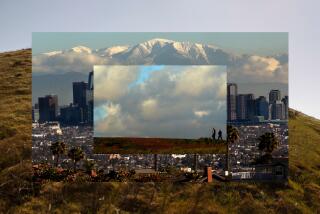
This hike uses the left fork and begins a moderate descent. Views from the shoulder of Simi Peak include Westlake Village, Agoura hills and other communities clustered on the Ventura-Los Angeles County line, as well as the peaks of the Santa Monica Mountains.
The trail ends at a gate on King James Court. Follow this short street one block down to Lindero Canyon Road and your vehicle.
(BEGIN TEXT OF INFOBOX / INFOGRAPHIC)
China Flat Trail
WHERE: Simi Hills, northeast of Thousand Oaks.
TERRAIN: Brushy slopes, sandstone outcroppings.
HIGHLIGHTS: Simi Peak, high point of Simi Hills, trail connections to national parkland.
DISTANCE: 5 miles round trip with 1,000-foot elevation gain
DEGREE OF DIFFICULTY: Moderate to moderately strenuos
FOR MORE INFORMATION: Santa Monica Mountains National Recreation Area, 401 W. Hillcrest Drive, Thousand Oaks, CA 91360; tel. (805) 370-2301; Rancho Simi Recreation and Park District (805) 584-4400.
More to Read
Sign up for The Wild
We’ll help you find the best places to hike, bike and run, as well as the perfect silent spots for meditation and yoga.
You may occasionally receive promotional content from the Los Angeles Times.


