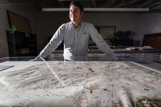
Martin Plamondon II, 58; Mapped Lewis and Clark Expedition
Martin Plamondon II, 58, a cartographer who spent 30 years mapping the 7,400-mile route of the Lewis and Clark expedition in a three-volume work, died Wednesday in his home near Vancouver, Wash. The Vancouver native had been in hospice care for multiple long-term health problems.
Besides “Lewis and Clark Trail Maps -- A Cartographic Reconstruction,” annotated with selections from the explorers’ journals, Plamondon wrote a novel based on their encounters with Indians, which is being edited by his daughter. He had worked as chief mapmaker for Clark County until failing health forced him to retire.
He became interested in Meriwether Lewis and William Clark after a visit to Fort Clatsop outside Astoria, Ore., in 1972. He said Clark, the expedition’s chief surveyor, had a poor sense of distance, and Lewis, who also drew a few maps, was far worse. Their maps, he said, resulted in a 1,000-mile miscalculation of the distance from the confluence of the Mississippi and Missouri rivers to the Pacific Ocean.
Plamondon’s first two volumes, published in 2000 and 2002, had a total of 336 new maps. As many as 200 more are expected in Volume 3, due out in July.
More to Read
Sign up for Essential California
The most important California stories and recommendations in your inbox every morning.
You may occasionally receive promotional content from the Los Angeles Times.


