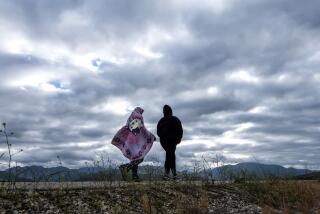
Another storm is expected next week
The warm Pacific storm that dampened the Southland on Friday will peter out over the weekend, but another, cooler storm system is on its heels. The result will be a cooling, cloudy weekend followed by rainfall early next week, forecasters say.
The first front, from out of the southwest, brought the first significant precipitation of the month, but it was not exactly a gully-washer.
By 4 p.m. Friday, the accumulation was 0.22 of an inch in downtown Los Angeles and Burbank, and 0.31 in Laguna Beach. On the high end was 0.87 of an inch at the Sandberg station, at 4,000 feet, along the Interstate 5 corridor near Gorman.
In an average January, 2 more inches of rain would have fallen on downtown Los Angeles by now. Instead, the city was a dry 80 degrees this week before the storm’s arrival.
Friday’s high of 66 degrees was not far off the historic average of 68 degrees. Today’s high will be virtually unchanged with an overnight low of 53 degrees.
“This is much more like a typical January situation,” said Jamie Meier, a meteorologist with the National Weather Service’s Oxnard station.
The clouds might not clear out before the next storm, which is coming from the north and is likely to arrive Monday or Tuesday.
“With this next storm we probably won’t catch up to normal rainfall, but we’ll make a dent,” Meier said.
The cooler front means snow levels will creep down from 6,500 feet tonight to 4,500 feet by early Monday.
--
More to Read
Sign up for Essential California
The most important California stories and recommendations in your inbox every morning.
You may occasionally receive promotional content from the Los Angeles Times.


