Second earthquake felt across Northern California; 4.7 temblor hits near Hollister
- Share via
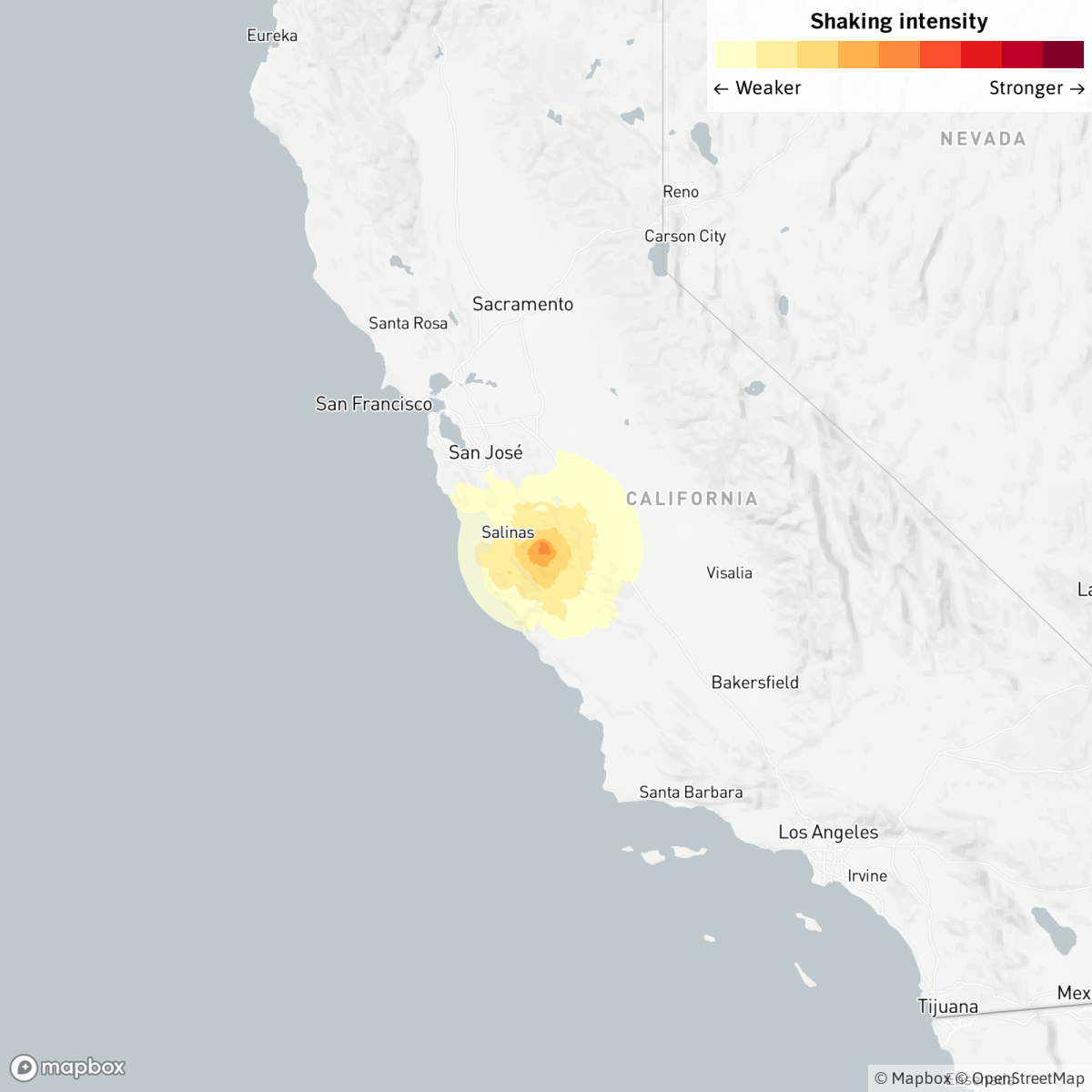
A magnitude 4.7 earthquake hit the Hollister area in San Benito County Tuesday, hours after the San Francisco Bay Area was rattled by a 4.5 temblor in the East Bay’s Contra Costa County 100 miles away.
The lunchtime quake at 12:42 p.m. was felt across the Bay Area and Central Coast, according to the U.S. Geological Survey. It was felt as far away as San Francisco, San Luis Obispo and the San Joaquin Valley. Strong shaking hit the remote Diablo range in between Monterey and San Benito counties, but only weak or light shaking was felt in the Salinas Valley, Monterey, Gilroy, Los Banos and the Bay Area.
Still, the quake caused swaying for several seconds on the fifth floor of a building in San Mateo County; in San Ramon in the East Bay, a chair could be be felt moving back and forth.
Earthquake scientists said the East Bay and San Benito County quakes were not related and are not part of the same fault system. Seismologist Lucy Jones tweeted that the earthquake happened in an area where numerous magnitude 4.0 to 5.0 temblors have occurred.
“Both events are having their own separate series of aftershocks,” USGS geophysicist Jonathan Tytell said. “They should not affect one another.”
Tuesday’s quake in San Benito County, initially reported as magnitude 4.8, occurred along the creeping section of the San Andreas fault, a length of about 90 miles that is notable for not having had dramatically large earthquakes in the modern historical record. Keith Knudsen, USGS geologist and deputy director of the agency’s Earthquake Science Center, called Tuesday’s quake “a garden variety San Andreas event” in this section.
“This is the 10th earthquake larger than magnitude 4 in the last 20 years in this area,” within a radius of about six miles from Tuesday’s epicenter, Knudsen said.
The stretches of San Andreas north and south of the creeping section have acted very differently in the modern historical period, rupturing in the state’s largest catastrophic quakes on record.
About 300 miles of the northern San Andreas fault, between San Juan Bautista in San Benito County and Cape Mendocino, ruptured in the great 1906 earthquake that destroyed much of San Francisco in shaking and fire.
A 225-mile stretch of the southern San Andreas fault south of this creeping section, from Parkfield in Monterey County to Wrightwood in San Bernardino County, ruptured in the great 1857 earthquake, the most powerful event in modern Southern California history. Both quakes are estimated to have been magnitude 7.8.
The creeping section hasn’t seen a big earthquake in the modern record. But the question of whether big earthquakes can continue to rupture through the creeping section of the San Andreas is still being studied, Knudsen said.
The USGS warned residents to prepare for the possibility of aftershocks. There is a 2% chance of one or more aftershocks with a magnitude of 4.7 or greater, and a possibility of zero to eight smaller earthquakes throughout the next week. If a larger aftershock of magnitude 3 or higher hit, it would most likely be felt near the epicenter.
“The number of aftershocks will drop off over time, but a large aftershock can increase the numbers again, temporarily,” USGS said in its aftershock forecast.
Tytell encouraged residents who felt the earthquake to share their experience with USGS by filling out the agency’s Did You Feel It? form. The information provides useful data for researchers.
The earthquake’s epicenter was 16 miles from Salinas, 19 miles from Prunedale and 21 miles from Greenfield.
In the last 10 days, there has been one earthquake of magnitude 3.0 or greater centered nearby.

An average of 25 earthquakes with magnitudes between 4.0 and 5.0 occur per year in California and Nevada, according to a recent three-year data sample.
The earthquake occurred at a depth of 6.0 miles. Did you feel this earthquake? Consider reporting what you felt to the USGS.
Find out what to do before and during an earthquake near you by reading our five-step earthquake preparedness guide.
This story was automatically initially generated by Quakebot, a computer application that monitors the latest earthquakes detected by the USGS. A Times editor reviewed the post before it was published; it has since been updated with more reporting. If you’re interested in learning more about the system, visit our list of frequently asked questions.
More to Read
Sign up for Essential California
The most important California stories and recommendations in your inbox every morning.
You may occasionally receive promotional content from the Los Angeles Times.


