Back-to-back Santa Ana winds will raise fire risk in Southern California

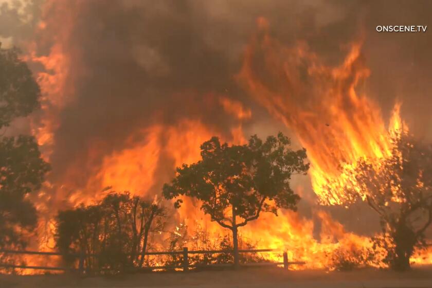
Southern California will be buffeted by back-to-back Santa Ana wind events this week, bringing an elevated fire risk to parts of the region.
The National Weather Service office in Oxnard expects the first round of high winds and low humidity to hit Los Angeles and Ventura counties overnight Tuesday and into Wednesday. A second round is possible Saturday.
Although the region was hit by record rainfall last week, not all areas received significant precipitation, said Lisa Phillips, a meteorologist with the Oxnard office.
Wednesday’s winds will dry out grasses, and the second round will further dry fuels, Phillips said, priming them for potential fires.
“Some areas did get quite a bit of rain, but we have to get at least 4 inches to officially end fire season,” she said. “We’re not there yet, unfortunately.”
A second body has been found in the wash in Ontario after about 10 people were swept down a storm drain during Tuesday’s record-breaking rain, authorities said.
A red flag warning will be in effect from 7 a.m. to 7 p.m. Wednesday for western Los Angeles County and much of Ventura County, according to the National Weather Service in Oxnard.
“Further drying Wednesday morning into the afternoon and continuing gusty and potentially damaging winds will likely support 6 hours or more of critical fire weather conditions during the warning period,” the weather service said.
Meteorologists warned of damaging winds out of the northeast with gusts peaking at 55 to 75 mph in wind-prone mountains.
Winds are forecast to be strongest Tuesday night through early Wednesday afternoon. Minimum relative humidity of 8% to 18% is expected Wednesday morning through the early evening.
“If fire ignition occurs there could be rapid spread of wildfire that would lead to a threat to life and property,” meteorologists said.
The weather service has also issued a high wind warning for 7 p.m. Tuesday to 7 p.m. Wednesday.
Northeast winds from 30 to 40 mph, and gusts up to 65 mph are expected in the mountains of Ventura and L.A. counties, meteorologists said.
The forecast for Saturday’s wind event is still evolving, but models show wind speeds could be 5 to 10 mph slower than Wednesday’s Santa Ana winds.
Moderate Santa Ana winds are expected to develop Tuesday morning and continue through the day. “This is going to be the biggest event this season,” the National Weather Service says.
Though winds over the weekend could be weaker, they’re still a risk, meteorologists said.
Residents should avoid using equipment like weed whackers, driving vehicles over dry grasses or any activity that could cause sparks, Phillips said.
Strong winds and dry air make sparks travel significantly farther than they normally would, increasing the risk of fire starts, she said.
A high wind warning will also be in effect from 8 p.m. Tuesday to 10 p.m. Wednesday for the valleys of San Bernardino and Riverside counties, the Inland Empire, San Bernardino County mountains, Santa Ana Mountains and foothills, and inland areas of Orange County, the weather service’s San Diego office said.
Northeast winds of 25 to 35 mph are expected with gusts up to 60 mph, the weather service said. Gusts up to 70 mph are possible below the Cajon Pass and near the coastal foothills of the Santa Ana mountains.
A red flag warning has not been issued for the Inland Empire or Orange County.
More to Read
Sign up for Essential California
The most important California stories and recommendations in your inbox every morning.
You may occasionally receive promotional content from the Los Angeles Times.


