Is it snow, graupel, sleet or hail? A guide to the epic SoCal storms

- Share via
In a mostly dry climate, a myth has emerged that it never snows in Los Angeles.
It rarely snows. But weather geeks are quick to point to 1949 as an exception that makes the rule.
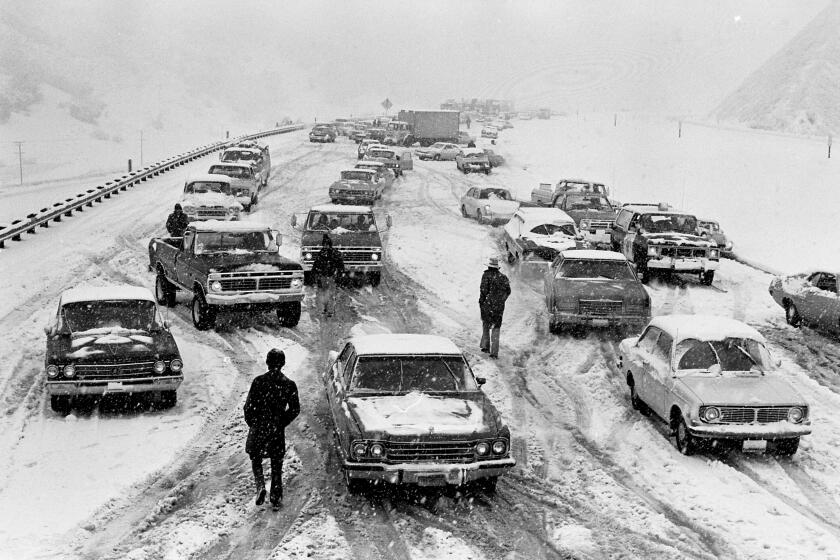
On Jan. 10, 1949, snow fell across the region, even on some freeways.
“Angelenos were forced to exchange their shorts and coconut oil for bulky jackets and gloves as flatland suburbanites scraped ice off windshields and downtown workers cursed the city’s hilly terrain,” Times reporter Cecilia Rasmussen wrote in 1999, on the 50th anniversary of the storm.
But some of what we think as snow really is not.
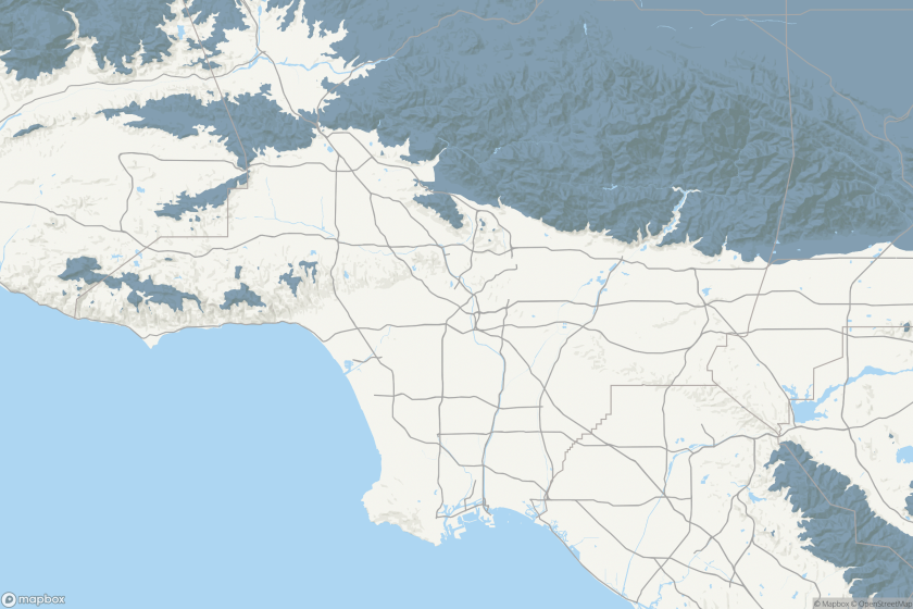
Could it snow near you? Check this map to see where SoCal might see snow for the first time in years
Late winter storms will bring snow to high elevation regions in parts of Los Angeles, Ventura and Santa Barbara counties.
Experts say the next two days could see historic snowfall in parts of California. But is it really snow?
Earlier, this week, many went to social media to report snow in downtown Sacramento. But the National Weather Service corrected them: “Have received reports of frozen precipitation making it to the ground in the Sacramento Metro this afternoon. With temperatures in the low 50s, this is a graupel and/or hail mixture, not snow. If it’s soft/wet, it’s graupel. If it’s hard/solid, it’s hail,” officials said on Twitter.
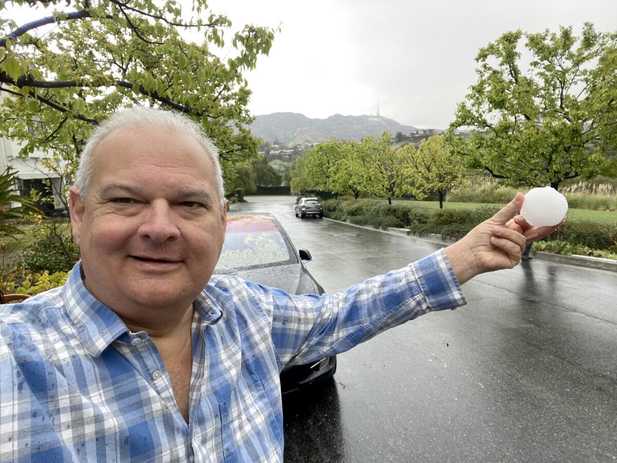
Was the white stuff found near the Hollywood sign on Thursday snow — or graupel or accumulated hail? There was debate.
The National Weather Service later confirmed that white stuff did indeed fall on the Hollywood sign. “After a little investigating ... we are confident in saying snow or graupel fell on Mt. Lee (where the Hollywood sign sits) this morning around 9:15 am,” the weather service tweeted .
As to whether it was snow or graupel — soft hail — meterologist Lisa Phillips, with the National Weather Service in Oxnard, said she couldn’t confirm without seeing it in person.
The incoming storm won’t be the first time Southern California has seen snow, but it will mark a highly unusual weather pattern for the region.
The sign sits at 1,578 feet, just above the 1,500-foot line at which the National Weather Service expected to see snow during the storm bringing frigid temperatures to Southern California.
Regardless, “it’s a very rare event,” said Jeff Zarrinnam, chairman of the Hollywood Sign Trust, who made a snowball beneath the world-renowned landmark.
Here is a breakdown of the different terms, and their meanings, from the National Oceanic and Atmospheric Administration’s National Severe Storms Laboratory.
Snow
Snow forms mainly when water vapor turns to ice without going through the liquid stage. This process is called deposition. Snow can form in the gentle updrafts of stratus clouds or at high altitudes in very cold regions of a thunderstorm. The snowflakes that most of us are used to seeing are not individual snow crystals, but are actually aggregates, or collections, of snow crystals that stick or otherwise attach to each other. Aggregates can grow to very large sizes compared to individual snow crystals.
Graupel
Graupel are soft, small pellets formed when supercooled water droplets (at a temperature below 32 degrees Fahrenheit) freeze onto a snow crystal, a process called riming. If the riming is particularly intense, the rimed snow crystal can grow to an appreciable size, but remain less than 0.2 inches. Graupel is also called snow pellets or soft hail, as the graupel particles are particularly fragile and generally disintegrate when handled.
Sleet
Sleet are small ice particles that form from the freezing of liquid water drops, such as raindrops. At ground level, sleet is only common during winter storms when snow melts as it falls and the resulting water refreezes into sleet prior to hitting the ground. In thunderstorms, sleet is possible above the melting level where cloud droplets become supercooled and may instantaneously freeze when making contact with other cloud particles or debris, such as dust particles. Sleet is also called ice pellets.
Hail
Hail is frozen precipitation that can grow to very large sizes through the collection of water that freezes onto the hailstone’s surface. Hailstones begin as embryos, which include graupel or sleet, and then grow in size. Hailstones can have a variety of shapes and include lumps and bumps that may even take the shape of small spikes. Hailstones must be at least 0.2 inches in size.
Los Angeles and other nearby counties are bracing for a snowstorm unlike any seen in decades — or possibly ever.
“This could be really substantial,” UCLA climate scientist Daniel Swain said. “In fact, it could be a historically significant snowfall for parts of the Southern California mountains. This well may be the largest single-event snowfall in some parts of Southern California since the 1980s. This is a big deal.”
Similar wintry conditions occurred in 1989 — the first and only other time the weather service issued a blizzard warning in the L.A. area. Snow also made appearances in 2019, 2007, 1998, 1987 and 1974, according to Times archives. In 1962, heavy snow fell in the mountains and high desert and dusted parts of downtown and West Los Angeles before melting quickly.
More to Read
Sign up for Essential California
The most important California stories and recommendations in your inbox every morning.
You may occasionally receive promotional content from the Los Angeles Times.


