Heat wave hitting California is likely to bring hottest weather so far this year
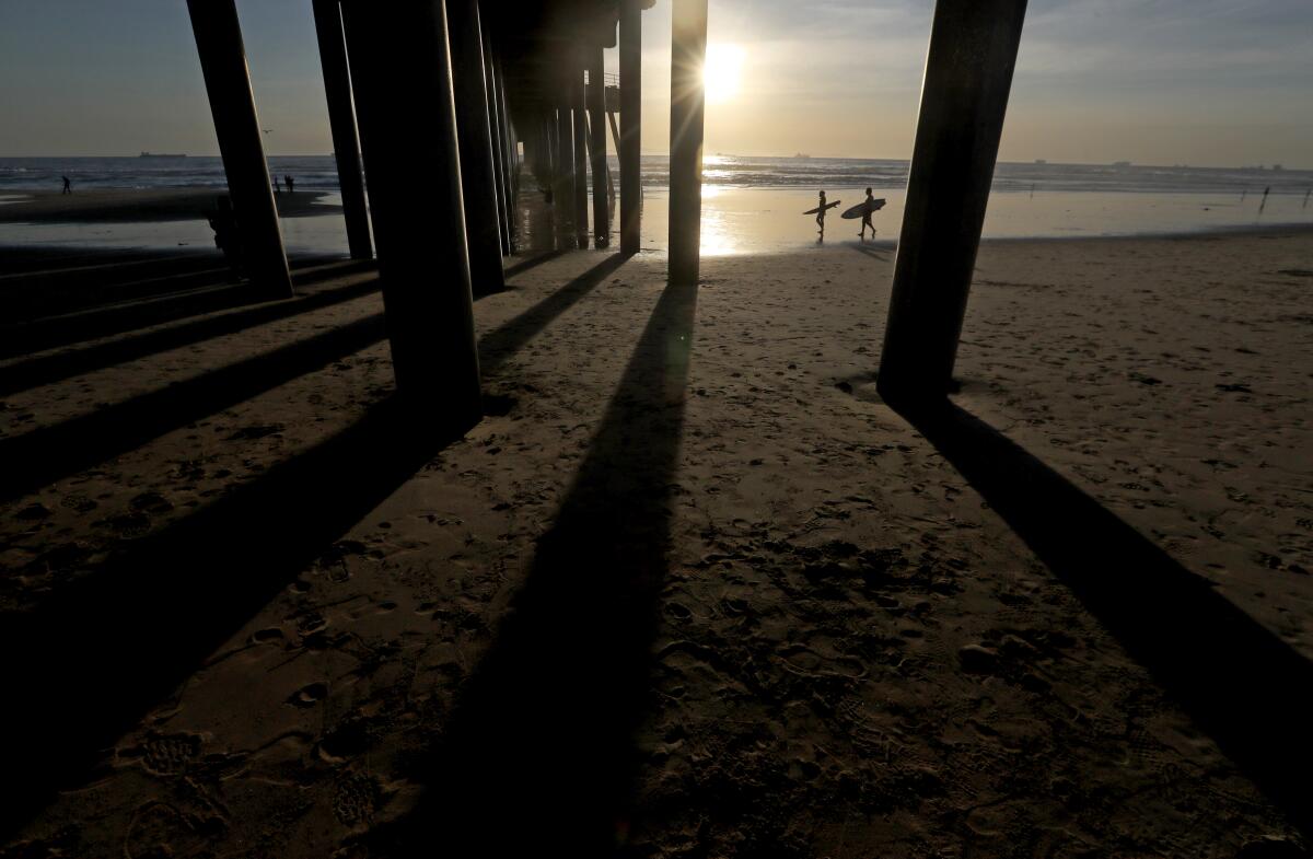
Temperatures across California started to rise Wednesday, kicking off a heat wave that’s expected to bring some of the state’s warmest days so far this year.
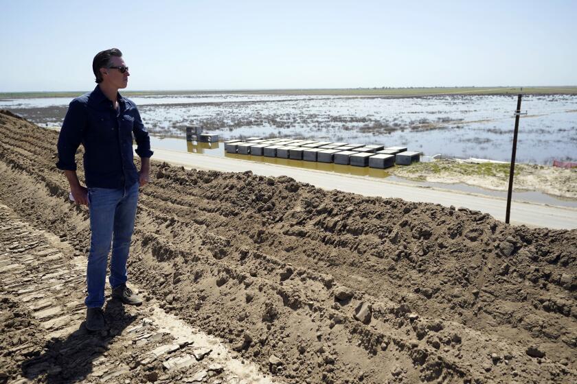
Highs are forecast to reach into the 90s and 100s by Saturday, which is expected to trigger increased snowmelt and flooding, primarily in the Central Valley. But weather officials said the heat affecting almost all of California should be short-lived, with a cold front expected to move in as early as Sunday and help stave off the worst-case scenario for flooding.
“It does look like after this hot spell, temperatures are going to remain below normal for a while after that,” said David Spector, a National Weather Service meteorologist in Hanford. “It’s going to prevent [the flooding] from getting out of control; the rivers are still going to overflow their banks.”
Much of the Central Valley is expected to see temperatures in the the upper 90s by Saturday, Spector said, which he called “unseasonably warm” but not extreme. Yet that warming has put many parts of the region on alert for an increased risk of flooding.
Portions of Kings, Tulare and Fresno counties along the Kings River are under an indefinite flood warning as water releases continue at Pine Flat Dam, with flooding expected in Sanger, Reedley, Laton and other flood-prone regions, according to the National Weather Service.
A flood advisory, one step below a warning, is in effect until further notice along the San Joaquin River in Fresno and Madera counties, with minor flooding expected in low-lying areas including Fresno, Mendota, Biola, Friant and Millerton Lake.
With temperatures rising in California, Gov. Gavin Newsom pledged support Tuesday for Central Valley communities facing historic snowmelt and flooding.
Much of the Eastern Sierra and the Yosemite Valley are under a flood watch, meaning the risk has increased but is not imminent, through Tuesday, with the Merced River expected to spill over at Pohono Bridge and other flooding in Yosemite National Park expected. Much of the park will be closed Friday through at least Wednesday due to flood concerns.
“The flooding will probably peak usually after the hottest temperatures, so probably Sunday or Monday,” Spector said.
Temperatures on Wednesday hit the low 90s in places from Sacramento to Redding. The day also brought temperatures in the high 80s in inland areas of Southern California, with some areas reaching the low 90s.
Los Angeles County will see temperatures in the upper 70s on Thursday, with the valleys likely to be in the mid-80s, said David Sweet, a weather service meteorologist in Oxnard. Highs will continue to increase into the 90s by Friday and Saturday, about 10 to 15 degrees above average for this time of year, he said.
On Wednesday, many inland areas in San Diego, Riverside and San Bernardino counties reached the mid- to high 80s, and some desert areas reached the 90s, according to the weather service office in San Diego. By Saturday and Sunday, inland desert regions including Palm Springs and the Coachella Valley could see highs in the 100s.
High temperatures are also expected across Northern California, where forecasters warned of moderate heat risk, with highs into the 90s in parts of the inland San Francisco Bay Area through Friday.
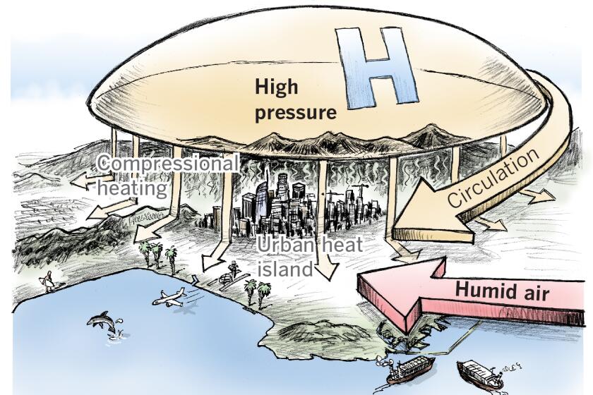
The heat wave was brought on by a ridge of high pressure building over the state, which is expected to ease by the end of the week, Sweet said.
California’s worst heat waves arrive in a one-two punch — high temperatures combined with humid air from Baja.
“The peak of it will be around Saturday with temperatures up near 90 degrees, then by Sunday, it starts cooling off again,” Sweet said. “It’s a very brief and very moderate warming trend. Then it’s going to be followed by a very extreme cooling trend.”
After the cooler weather returns early next week, there is the potential for rare early May precipitation, forecasters said. Weather officials remain optimistic that sustained cooler temperatures into May will help limit the flooding dangers from a big, fast melting of the snowpack, which could be triggered by a sustained heat wave.
“We’ll be going from very warm at the end of this week to very cool and possibly wet for the next week,” Sweet said.
Forecasters say cooler temperatures in May could help spare California a devastating spring snowmelt.
A low-pressure system dropping down from Canada along the California coast will bring the drastic change in weather, he said.
By Tuesday, the L.A. area could see highs back down in the lower to mid-60s, he said, with a 20% chance of rain.
The chance of rain next week in the Central Valley is a possibility, Spector said, but “still questionable” this far out.
More to Read
Sign up for Essential California
The most important California stories and recommendations in your inbox every morning.
You may occasionally receive promotional content from the Los Angeles Times.
