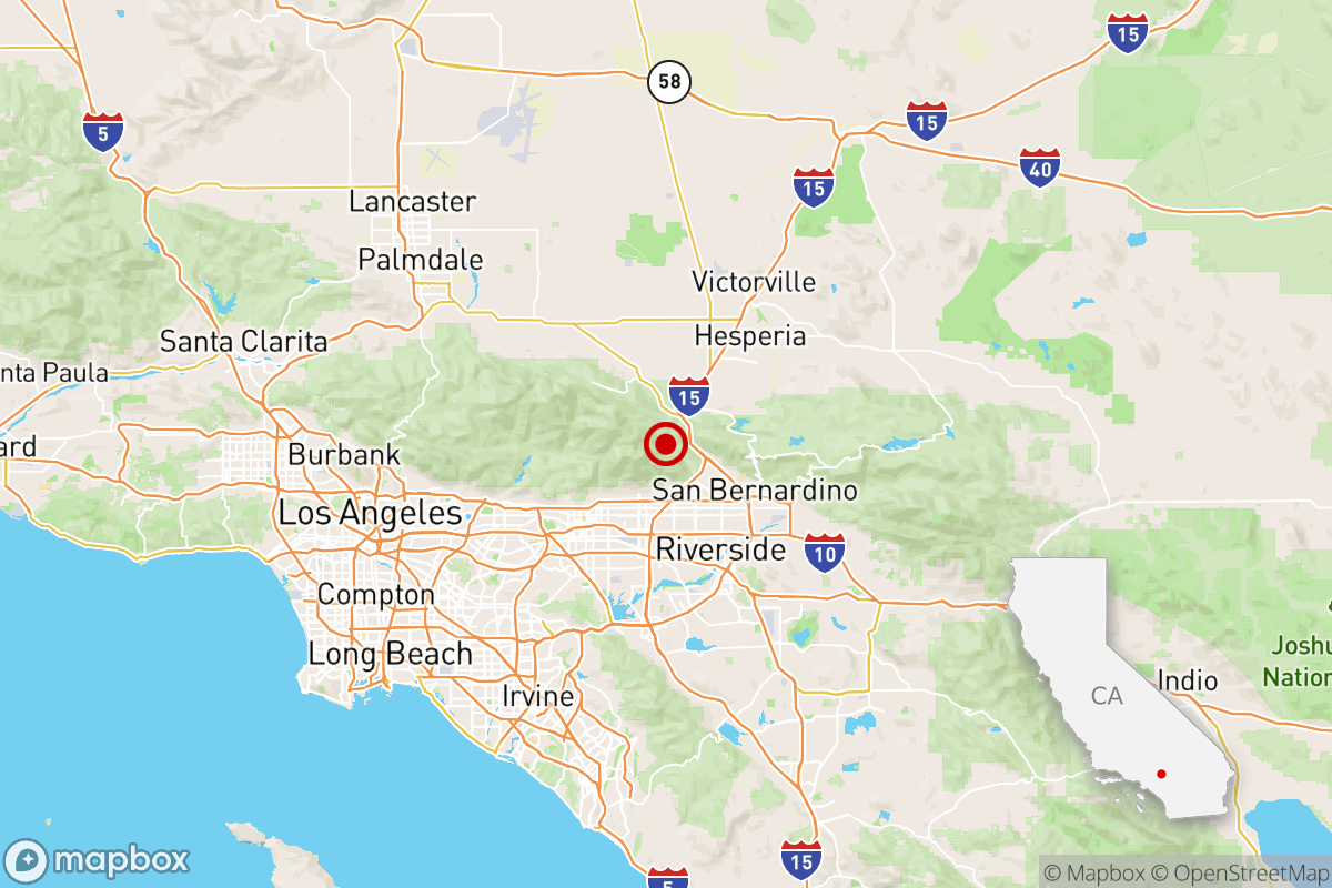
Magnitude 4.2 earthquake jolts Southern California

- Share via
A magnitude 4.2 earthquake rattled Southern California on Friday morning, less than a week after a magnitude 4.1 New Year’s temblor that shook attendees at the Rose Parade in Pasadena.
The earthquake, which struck at 10:55 a.m., brought light shaking to swaths of Southern California, as defined by the Modified Mercalli Intensity Scale, according to the U.S. Geological Survey. That’s enough shaking to rattle dishes and can feel like a vehicle striking a building.
The epicenter was about 1 mile northwest of the remote community of Lytle Creek in the San Gabriel Mountains of San Bernardino County, 12 miles northeast of Rancho Cucamonga, 27 miles northwest of San Bernardino and 45 miles northeast of downtown Los Angeles.
Residents in Fontana reported heavy shaking strong enough to set off car alarms. In Rowland Heights, people said they felt they were being rocked back and forth and the doors and beds shook.
The epicenter was near Lytle Creek in the Cajon Pass, seismologist Lucy Jones wrote on social media. Jones noted this is where “the San Andreas and San Jacinto faults come together. In 1970, there was a M5.2 with a M4.0 foreshock in close to the same location.”
The guide to earthquake readiness and resilience that you’ll actually use.
David Loyola was about to bite into his chicken bake at the Rancho Cucamonga Costco when the rumbling interrupted his lunch. He stared at his co-worker sitting across from him.
“What the hell,” Loyola said, as he felt his body jump up and down, akin to driving over a speed bump. The two FedEx employees looked at each other, then at their surroundings to make sure they “weren’t acting crazy.” Nothing appeared to be broken or toppled over by the earthquake but “people just looked astounded,” he said.
Minutes later, his wife called to check in on him. “Yeah, I’m good,” Loyola told her. “It just interrupted my lunch.”
Weak to light shaking was felt throughout Los Angeles, Orange, Riverside, San Bernardino and Ventura counties, as well as in northern San Diego County and parts of the Mojave Desert. The earthquake occurred just west of the Cajon Pass, through which Interstate 15 runs, the main route between Southern California and Las Vegas.
The California Department of Forestry and Fire Protection said there were no reports of damage or calls for service related to Friday’s earthquake. The Los Angeles Fire Department also reported no injuries or structure damage.
Los Angeles Mayor Karen Bass reminded Angelenos about being ready for the next earthquake.
“An earthquake just shook the L.A. area this morning,” Bass wrote on social media. “This is a reminder that earthquakes can happen at any time. Make a plan to prepare for emergencies at ReadyLA.org.”
Some people feel those SoCal earthquakes and others don’t feel them at all. If you’re in the latter camp, tell us all about it.
An average of 25 earthquakes with magnitudes between 4.0 and 5.0 occur per year in California and Nevada, according to a recent three-year data sample.
The earthquake occurred at a depth of 5.6 miles. Did you feel this earthquake? Consider reporting what you felt to the USGS.
Find out what to do before, and during, an earthquake near you by signing up for our Unshaken newsletter, which breaks down emergency preparedness into bite-sized steps over six weeks. Learn more about earthquake kits, which apps you need, seismologist Jones’ most important advice and more at latimes.com/Unshaken.
An earlier version of this report was automatically generated by Quakebot, a computer application that monitors the latest earthquakes detected by the USGS. If you’re interested in learning more about the system, visit our list of frequently asked questions.
More to Read
Sign up for Essential California
The most important California stories and recommendations in your inbox every morning.
You may occasionally receive promotional content from the Los Angeles Times.


