- Share via
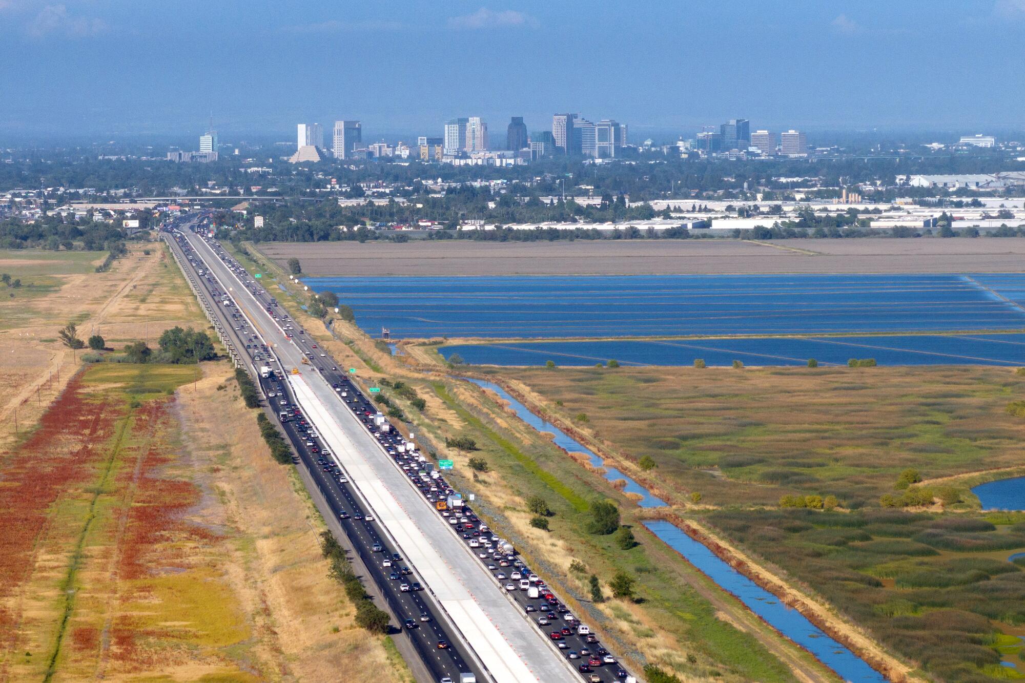
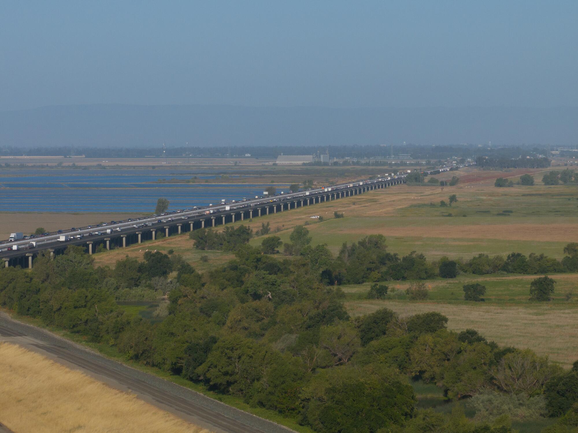
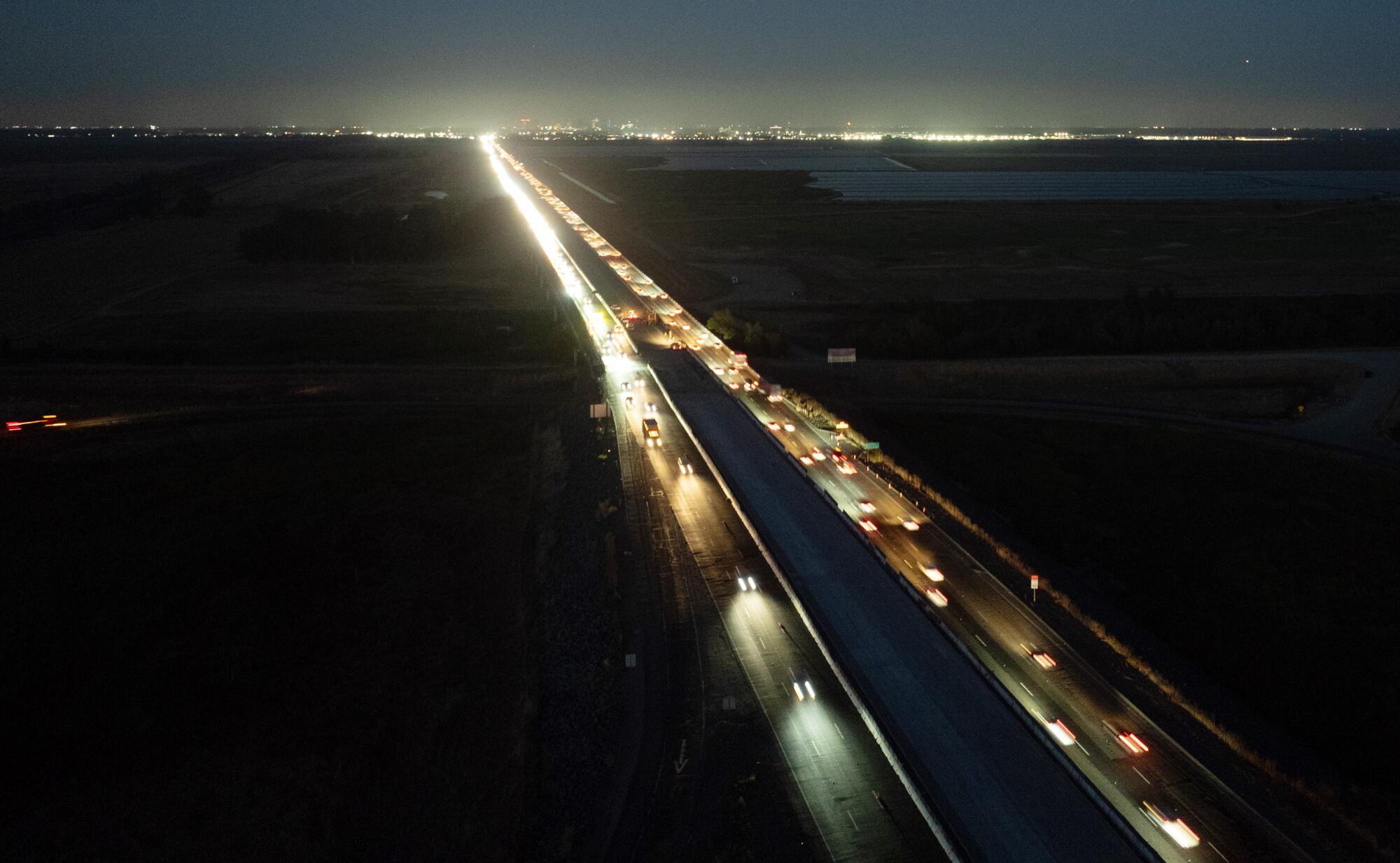
Underneath the Yolo Causeway near Sacramento, where a nearly half-billion-dollar effort is underway to add toll lanes to Interstate 80 and ease congestion, swollen rivers fill wetlands in the winter season and bat colonies roost in the bridge’s grooves in warm months.
More than a century old, the road that connects the Bay Area to the state capital has become a symbol and a test of both the future of highway expansion in California and the climate change policies that seek to restrict it.
“It’s a bellwether project,” said Carter Rubin, director of state transportation advocacy at the Natural Resources Defense Council, one of the groups suing Caltrans to stop the expansion. “But it’s also the tip of the iceberg.”
Dozens of major highway projects are in the pipeline, including one along the 5 Freeway in Orange County and an express lane on the 10 Freeway in eastern Los Angeles County, that could result in even more cars clogging state roadways. The lane additions on I-80, Rubin argued, should be a cautionary warning: State officials who have promised to halt the expansion of traffic-inducing freeways that contribute to climate change are the same ones overseeing them in the name of relieving gridlock.
The California Department of Transportation has projected that the project will add 110 million vehicle miles traveled annually on I-80. But officials say half that total will be negated by increasing Capitol Corridor rail and bus services, subsidizing bus fares and creating pedestrian and bike routes — with the new toll fees helping to pay for public transit.
The toll lanes have been “thoroughly vetted by state and federal officials,” Caltrans spokesman Edward Barrera said. “The new tolled express lanes are expected to reduce delays for motorists and improve goods and freight movement.”
Analysis by the agency found the I-80 project would cut greenhouse gas emissions by reducing congestion.
But researchers say decades of academic work show it will do the opposite in the long run.
Congestion, they argue, is a deterrent to drivers. And when it eases with more lanes, they will fill the added space until the congestion returns. So the more freeways are widened, the more cars take to the road — even as California aims to cut motorists driving by 30% by 2045.
This year, a former Caltrans executive said she was demoted after raising concerns about a repaving project that surreptitiously widened 3½ miles of the freeway where the toll lanes were being proposed. That project removed bushes and paved the median, creating more space for lanes. State regulations demand environmental analysis, a public airing and mitigation before major freeway widening, but none of that occurred.
California’s own air regulators pointed out that in doing the environmental analysis for the new toll lanes, Caltrans had used models that exaggerated future congestion without the new lanes and underestimated pollution and greenhouse gas with them.
Wildlife regulators say Caltrans declined to incorporate their suggestions to fully protect habitat for threatened species or preserve roosting grounds for the bats, and now environmental groups — including Rubin’s —are suing to stop the toll lanes.
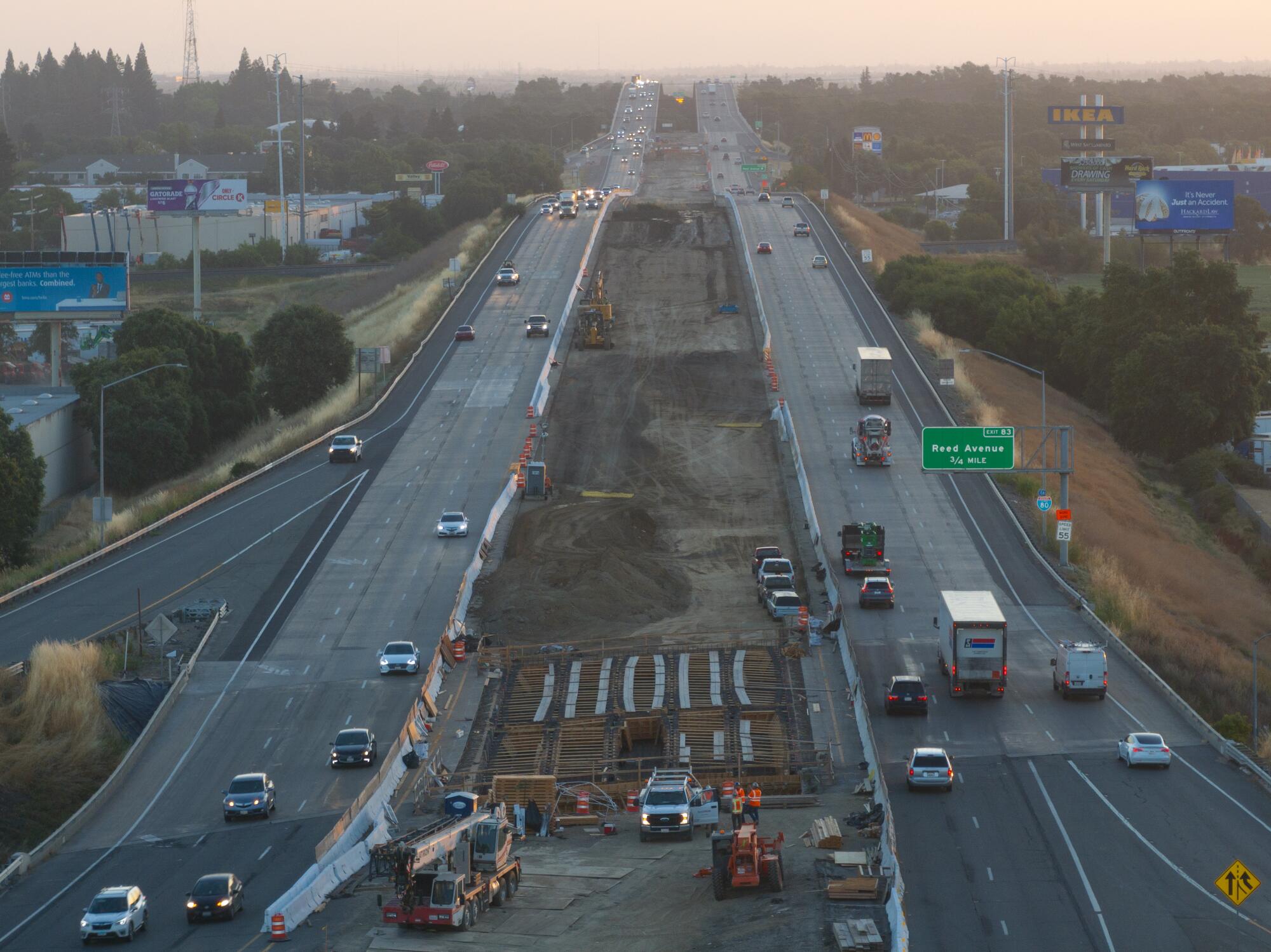
What makes this highway project stand out, transportation experts said, is what it may mean for how courts will interpret rules that are intended to reduce driving — the state’s largest source of greenhouse gas. California is nowhere near meeting that goal.
“These projects are being oversold to the public as a way to reduce congestion; they are not,” said Susan Handy, director of the National Center for Sustainable Transportation at UC Davis. “A court decision is going to be very important.”
The 17-mile stretch of I-80 where the toll lanes will go sits along bucolic agricultural lands, between the college town of Davis and the bustle of Sacramento. It is often traffic-choked when the weekend approaches, serving as the primary route for Bay Area travel to Lake Tahoe and other points inland, as well as a key corridor for freight from the Port of Oakland.
More than 100,000 commuters travel the road daily. The highway narrows from eight to six lanes at some points when crossing the Yolo Bypass Wildlife Area, home to 280 species including burrowing owls, egrets, white-faced ibises and the threatened tricolored blackbird, whose males have a distinctive fiery red shoulder.
The slow traffic on I-80 pushes impatient drivers to cut through neighborhoods in Davis and Sacramento, clogging streets and frustrating residents.
“We experienced some of the most severe congestion in California seven days a week,” Autumn Bernstein, executive director of the Yolo Transportation District, said last month. “We have more than five hours of congested traffic in the eastbound direction and [in] Davis every afternoon.”
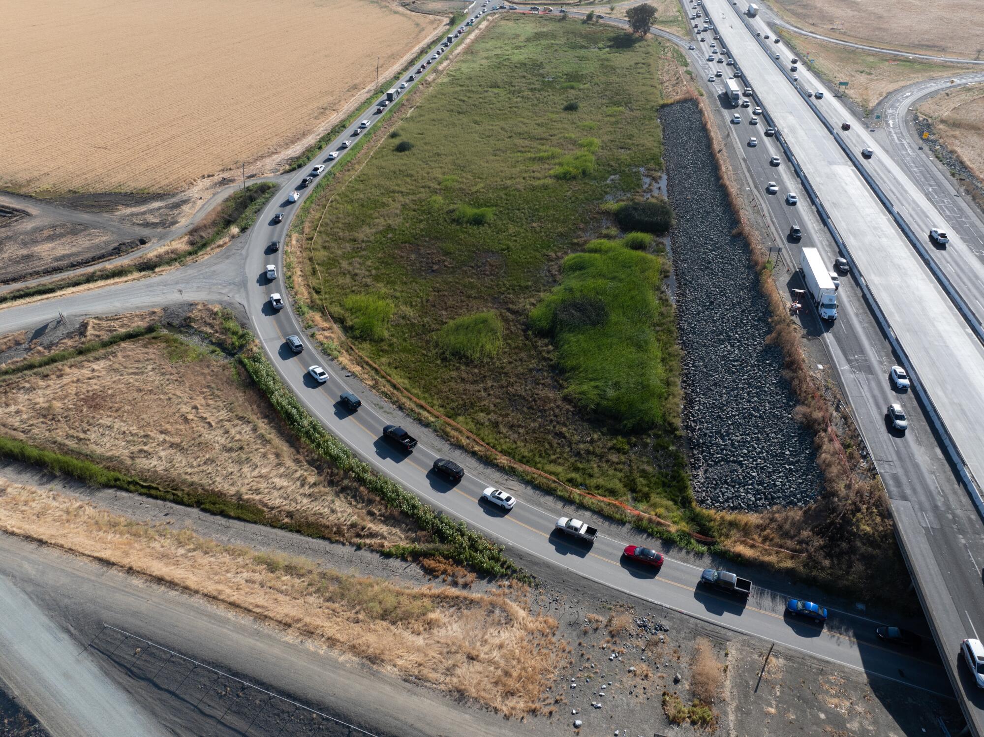
The bottlenecks nagged at Caltrans District 3 officials for years as they tried to get their bosses to prioritize a new freeway carpool lane for federal funding, said Amy Lee, a postdoctoral scholar at the UCLA Institute of Transportation Studies who documented the project’s evolution in her dissertation on the politics of highway expansion. Failing, the district bypassed Sacramento and looked to the Yolo Transportation District, an agency with a $25-million budget focused on public transit and planning.
The strategy worked. Rep. John Garamendi (D-Walnut Grove) announced an $86-million federal award for the project in 2021, touting it as a “major victory.” Yolo officials used their newfound leverage to push for toll lanes that would benefit public transit.
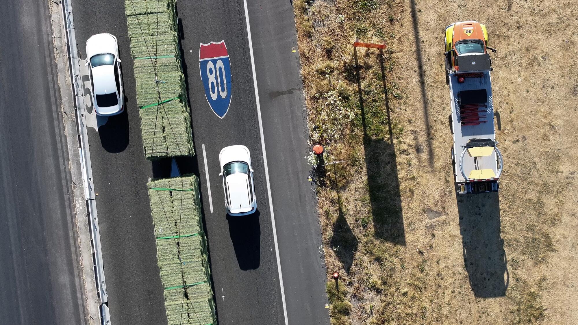
With money lined up for the new lanes, Caltrans embarked on a pavement maintenance program along the same stretch. Jeanie Ward-Waller, former deputy director of planning and modal programs for the agency, warned that the freeway was being widened to jump-start the toll lane proposal. She raised red flags, saying the move probably broke laws. She was eventually demoted and filed a lawsuit against the agency in April.
The environmental analysis for the toll lane expansion finally got cleared last month by the California Transportation Commission. The 11 voting members of the panel provided the agency $105 million in state funds to unlock the federal funds for the first phase of the project. And they greenlighted tolling, which Caltrans said will ease congestion by as much as 80% eastbound during evening rush hour. Unions and construction companies that build highways cheered the vote.
“We know that for every billion dollars invested in infrastructure 15,000 jobs are created,” Jon Switalski, executive director of the Rebuild SoCal Partnership, told the commission last month. The group represents 2,700 contractors along with trade unions that push for more infrastructure funding.
“It’s a false equivalency to say that we cannot meet our climate change goals and not continue to invest in our roads, bridges and highways,” he said
But the environmental groups that sued Caltrans argued that the environmental review didn’t reflect the amount of traffic, pollution and greenhouse gas the new lanes will bring. And by doing the pavement rework separately, they said, Caltrans is illegally splitting the project in two.
The groups also argue that Caltrans hasn’t done enough to offset the potential increase in traffic, as required by law.
“To fully mitigate it,” Sergio Aceves, acting District 3 director, told the commission last month, “it’s about 2 billion [dollars]. It’s not feasible.”
To reduce the added car miles driven, he suggested, new housing would have to be built to shorten people’s commutes — and it would take years, if not decades.
“Caltrans only knows one way of doing things, and that’s build wider freeways,” said Alan Pryor, chair of a local Sierra Club chapter, which has filed a lawsuit with the Environmental Council of Sacramento. “We have to challenge them and say, ‘No, you have to comply with state law … and minimize our dependence on automobiles going forward.”
For more than a decade, various policymakers have attempted to cut car use through rules that encouraged the reduction of greenhouse emissions. But the state’s strong car culture prevails.
According to environmental advocates, the I-80 project will be the biggest test yet of a 2013 reform to the California Environmental Quality Act intended to reduce driving.
That legislation came from the then-state Senate president pro tem, now Sacramento Mayor Darrell Steinberg, who wanted to build an arena for the NBA’s Sacramento Kings. To get the project done, he reportedly made a deal with then-Gov. Jerry Brown, who had been looking for ways to address climate change.
One of the big challenges for the Brown administration was reducing greenhouse gas, but the 1970s-era law that requires developers and agencies such as Caltrans to mitigate environmental harms favored suburban development and encouraged sprawl.
That’s because CEQA required developers to measure traffic based on backups and other factors, as opposed to how many miles were actually driven.
Ken Alex, then a key Brown climate advisor, pushed the idea to use vehicle miles traveled, or VMT, instead in order to encourage urban housing development and stem the increase in car driving.
Steinberg authored Senate Bill 743, which streamlined the CEQA process to include this reform. Brown signed it into law that year.
“From the outset, it was meant to apply to highway projects and to Caltrans,” Alex said. Although it is still being implemented in many parts of the state, he said, it has been one of the most significant reforms in California environmental law.
“Caltrans has for the most part, I think they’ve embraced it more than I would have expected in some ways, and a little less in other ways,” he said.
Handy, of UC Davis, who co-created a calculator that estimates vehicle miles traveled for new freeway lanes, said in this case Caltrans used the model to calculate miles, but not project pollution and greenhouse gas emission. Nor did the agency calculate the number of freight trucks that the new lanes would add.
VMT has become one of the biggest dividing lines in transportation policy. Understanding how it’s calculated and applied is complicated, even for those making decisions based on it. But it could determine what a project would look like and how costly it will be to mitigate.
“It’s deeply technical stuff,” Adonia Lugo, a California transportation commissioner, said before approving the project. “And we’re talking about different parts of the process needing to use different kinds of metrics based on what information is available.
“What we end up with are these confusingly different answers sometimes,” she said. “I’m concerned about how that erodes public trust in terms of, you know, which answer do we go with, and why do we go with that answer as opposed to another.”
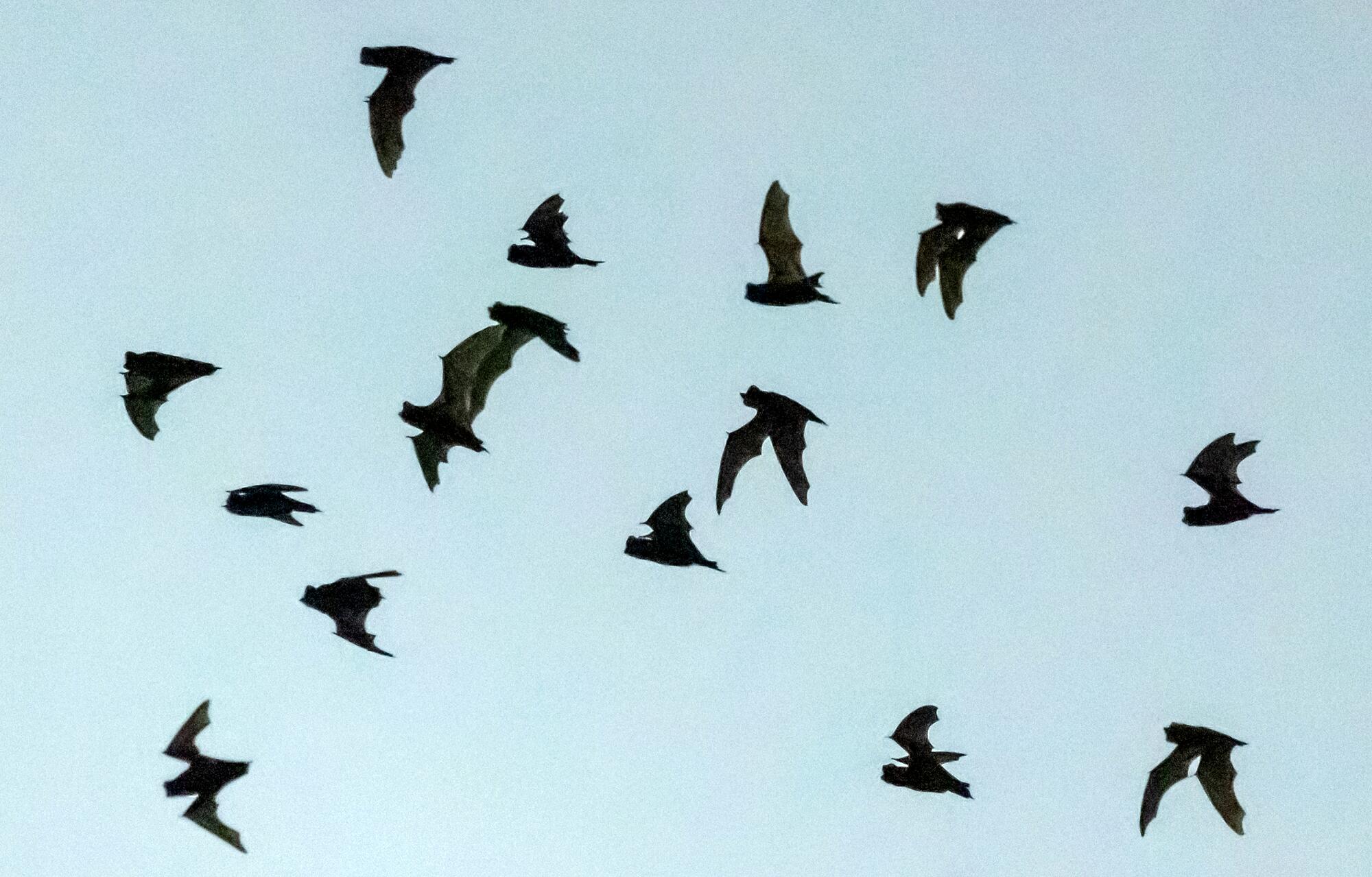
Along the Yolo Causeway thousands of bats emerge from the underpass like a wave over the sky. Mexican free-tail bats and two other species live there in one of the largest colonies in the state, coming out at night to hunt insects.
Corky Quirk, founder and executive director of Northern California Bats, said since highway construction along the corridor began more than a year ago, the bats’ behavior has been off.
“Normally, I know exactly where to go, exactly where to stand and pretty much what the bats are going to do. ... It’s pretty darn consistent on where they exit that bridge,” she said. “Last summer I could not predict from night to night where that was.”
She believes the erratic behavior is related to Caltrans’ ongoing pavement work.
California Department of Fish and Wildlife officials said they are concerned about the construction. And as part of the toll lane, they have requested Caltrans create a plan that would ensure the bats aren’t disturbed going forward, especially in their roosting season. But the agency said in its response letter that there would be no need because there wasn’t any lane construction on the bridge, only restriping.
Caltrans also declined to add other protections for nearby wildlife. The threatened Swainson’s hawk will lose 10 acres of foraging habitat with the project, and the tricolored blackbird relies on nearby areas for food and its nesting materials.
“It’s definitely disappointing,” Melissa Stanfield, a senior environmental scientist at Fish and Wildlife. “We spend a lot of time trying to help right this partner agency, reduce their impacts to biological resources to a less than significant levels.”
J.P. Rose, a senior attorney and urban wildlands policy director for the Center for Biological Diversity, put it more bluntly.
“Caltrans completely blew off all of California Department of Fish and Wildlife recommendations,” Rose said.
More to Read
Sign up for Essential California
The most important California stories and recommendations in your inbox every morning.
You may occasionally receive promotional content from the Los Angeles Times.


