SoCal monster fires explode: Homes burn, 13 hurt, communities threatened
Time lapse of Airport fire. (AlertCalifornia)
- Share via
Three wildfires raged in Southern California on Tuesday night, one moving down into the Inland Empire from Orange County, one in San Bernardino County and the other near the mountain communities of Mt. Baldy and Wrightwood. At least 13 people have been injured in the fires.
The Bridge fire took a dangerous turn Tuesday night as it exploded from 4,000 acres to 34,000 acres in a matter of hours, growing more than eight times its size as it raced toward the Mountain High ski resort and Wrightwood.
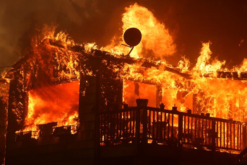
Several homes burned near Wrightwood and along the Ortega Highway. But it’s unclear how many.
One video from Mountain High showed flames burning through a ski lift area. Other videos showed wind-fueled flames jumping across hillsides and eating up terrain.
After a heat wave struck Southern California, fires erupt across the Southland, burning hundreds of thousands of acres while threatening homes.
Fire activity in the blaze, which broke out in the Angeles National Forest, was increasing in the northeast area, the Angeles National Forest reported Tuesday afternoon. Fire danger levels have been elevated to “very high” for visitors in the area, including the San Gabriel Mountains National Monument. The fire has triggered mandatory evacuation orders for local communities.
The Line fire in San Bernardino County began Thursday and had scorched nearly 33,000 acres, with 14% containment as of Tuesday night, Cal Fire said. Evacuations were in place for several communities southwest of the fire in case the winds turn.
As of Tuesday evening, the disaster assessment team had not reported any structural damage caused by the Line fire. But, according to a Times photographer, at least one home went up in flames on Pine Cone Drive in Running Springs. Thick smoke blanketed the street, making it difficult for firefighters and bystanders to breathe.
In the first couple of days of the fire, three firefighters were injured before incident management officially took over the response Saturday evening, spokesperson Arnold Menjivar said.
A 34-year-old man was arrested on suspicion of arson in connection with the Line fire. Authorities on Tuesday arrested Justin Wayne Halstenberg, a resident of Norco. He is suspected of starting a fire in the area of Baseline Road and Alpine Street in Highland on Thursday, according to the San Bernardino County Sheriff’s Department.
Halstenberg is being held on a $80,000 bail.
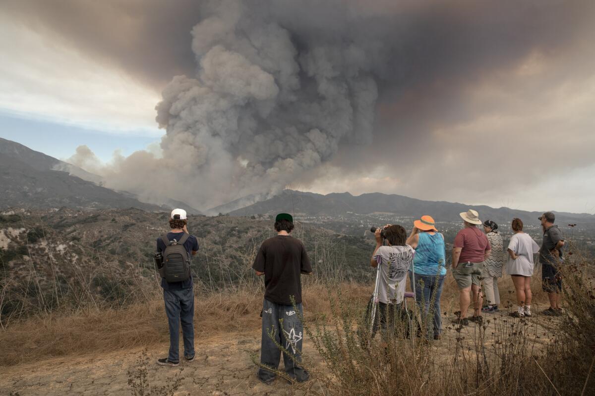
In Orange County, the Airport fire had grown to more than 19,000 acres and was 0% contained as of Tuesday night.
It started Monday afternoon amid a stubborn heat wave that fueled fires across the region, brought winds that poisoned the air with smoke and ash, and forced schools and businesses to close until conditions improved.
In its first hours, the fire raced up Trabuco Canyon and away from foothill neighborhoods such as Robinson Ranch.
But Tuesday morning, a plume of thick gray smoke blanketed the hillside above.
A total of eight firefighters and two civilians were injured and sent to local hospitals for treatment Monday and Tuesday, Orange County Fire Authority Capt. Sean Doran told The Times. Two of the victims sustained burn injuries.
OCFA did not provide information on the status of the patients or the severity of their injuries.
Structures in Orange County have been affected, but officials could not confirm the number of structures damaged as of Tuesday night.
“The terrain has been difficult to access so we have not sent in our damage assessment team yet,” Doran said. “The damage assessment team will access and assess those structures when it’s safe to do so.”
Fire officials were working to move resources from smaller area fires to the three major fires in the Southland, as well as out-of-state resources through the Emergency Management Assistance Compact program, Cal Fire Battalion Chief Todd Hopkins said at a Tuesday news conference.
“We are getting resources released from fires like the Roblar fire or Boone fire,” he said, which were both more than 50% contained. “Resources are being reassigned to [the Airport fire] or some of the other fires that are ongoing in the south.”
Robinson Ranch resident Michael Bernardin, 62, wasn’t home when the Airport fire broke out Monday.
When he tried to go home, the road into the neighborhood already was blocked off. He parked in a shopping center and walked the roughly half-mile stretch to his house in the heat. He packed two suitcases — all he could carry — and grabbed his dogs, Pepper and Honey Noodles. He went back a second time to grab more items, unsure of when his family could return home.
“One of the suitcases was so loaded that I don’t think we could have checked it in on an aircraft,” he said. “It was hot and I was struggling.”
On Tuesday morning, Bernardin and his wife, Roseann, made the trek back to their house after staying with a friend in San Clemente. They’re planning to stay put unless the winds shift, he said.
In the 27 years they’ve lived in the area, there have been a few fires, but this is the first time they’ve had to evacuate.
“I didn’t sleep much last night,” he said.
With its proximity to nature and open space, the features that make Trabuco Canyon an attractive community for residents also make it vulnerable to massive fires.
Resident Marilynn Reideler was driving around the neighborhood in her Ford F-150 truck giving rides to residents who were struggling up the hill with heavy suitcases and bags.
“It’s still hot and it’s a long walk,” she said.
Despite the orders to evacuate, many residents, including Reideler, decided to watch and wait before committing to leave.
Robert McCoy happily accepted a ride midmorning as temperatures climbed into the high 80s on Tuesday. He and his wife had left Monday out of an abundance of caution but now felt safe returning.
“The firefighters are on it,” McCoy, 61, said. “I wanted to stay [Monday], but [my wife] was nervous.”
According to Orange County Fire Authority investigators, the cause of the Airport fire was a spark from heavy equipment used by workers to place large boulders on Trabuco Creek Road and was considered unintentional.
The Airport fire is burning near homes in south Orange County and has forced evacuations. Here are details on the fire.
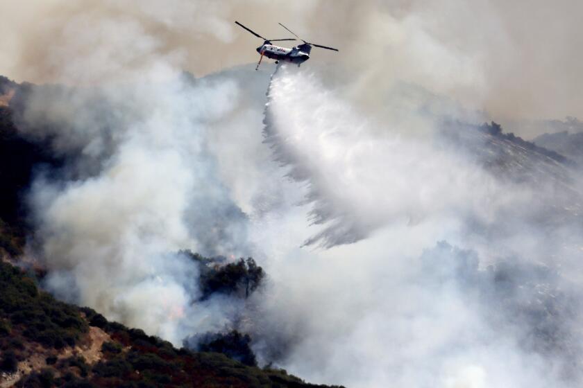
About 1,000 firefighters were battling the blaze while helicopters were dumping thousands of gallons of water on the flames and planes lined the hills in pink retardant in an effort to block its path. The Orange County Board of Supervisors on Tuesday declared a state of emergency because of the fire.
Steve Kilgore stood watch outside his home on Raintree Lane with a pair of binoculars as the flames devoured brush along the ridge above his neighborhood.
Kilgore and his neighbors who have stayed behind are working in shifts throughout the night to monitor the fire and determine whether and when to leave. His truck is packed with family photos and essentials in case the winds shift.
“There’s something about leaving your home in this situation — it’s awful,” he said. “It defies logic. I’ve never had to do a 20- to 30-minute assessment of every valuable thing in our lives.”
Wayne Nelson, who also lives on Raintree, with his property backing up against the Cleveland National Forest, stood with his wife in their driveway watching as a helicopter dropped thousands of gallons of water on the inferno.
He said fire trucks stayed in their neighborhood through the night watching the fire’s moves.
“Firefighters saved these homes,” he said. “It was literally an air show here last night. We’re so grateful for them.”

As temperatures at the fire climbed into the 90s on Tuesday, the blaze crested the Santa Ana Mountains and marched north and east toward Riverside County.
Officials anticipated that the fire would continue to grow; there was no direct threat to homes in Orange County.
“That’s the overall goal of any fire,” said Orange County Fire Authority Capt. Steve Concialdi. “It’s OK to burn in the natural vegetation, but we don’t want it to burn any homes or businesses.”
The Orange County Sheriff’s Department encouraged residents living along Rose Canyon Road, Trabuco Creek Road, Trabuco Canyon Road, Trabuco Oaks Drive, Joplin Loop and Cook’s Corner to evacuate. Homes in the Robinson Ranch and Trabuco Highlands communities were under mandatory evacuation orders. The Highlands apartment complex was also under mandatory evacuation orders.
A long-term shelter was established in Rancho Santa Margarita, and large animals could be taken to the Orange County Fairgrounds in Costa Mesa.
Another brush fire broke out Tuesday morning in Fairmont, about 70 miles northwest of Los Angeles. The Apollo fire had spread to 800 acres within the first five hours, but it has since been 100% contained, officials said.
Wildfires scorch thousands of acres in mountain communities of San Bernardino County near Lake Arrowhead and in the Angeles National Forest north of Glendora.
According to the National Weather Service, the days of unseasonably hot weather should end Wednesday, but not before firefighters are presented with a few more challenges from the heat and wind.
Firefighters were expected to face another day of temperatures in the mid-90s and 20-mph winds Tuesday, said Philip Gonsalves, a meteorologist with the weather service in San Diego.
“It’ll literally fan the flames,” he said. “It increases the rate at which the fire will spread. That’s the bad news. The silver lining is that the direction of spread becomes a little more predictable.”
Winds from an incoming low-pressure system are expected to bring smoke from the Bridge, Line and Airport fires into southern Nevada and Arizona over the next few days, according to the weather service.
Nicole Bennigsdorf, 40, has lived in the foothills of Trabuco Canyon for more than 12 years, during which she has experienced about five fires in the area. But never has a fire come close enough to her Rancho Santa Margarita home for her to see flames.
“I can see the red orange amber on the ridge, which I’ve never seen before,” she said, standing outside her home about seven miles south of the Airport fire.
After Bennigsdorf began seeing news of the fire on the social media platform X on Monday afternoon, she stepped outside around 3 p.m. to hot, muggy air and a large plume of smoke in the distance.
“It was a very defined plume, very dark, and it was much windier outside than it was at 2 p.m., and the base [of the fire] just grew wider, wider and wider,” she said.
By 4 p.m., the sounds of helicopters flying in and out of the smoke filled the neighborhood as she saw three or four aircraft at a time, dropping water and retardant on the fire.
“This is the largest [fire] I’ve seen, and it’s definitely been the hottest and muggiest weather we’ve had, and it’s just made it brutal out here,” she said. “I’m drenched in sweat just standing still outside.”
More to Read
Sign up for Essential California
The most important California stories and recommendations in your inbox every morning.
You may occasionally receive promotional content from the Los Angeles Times.


