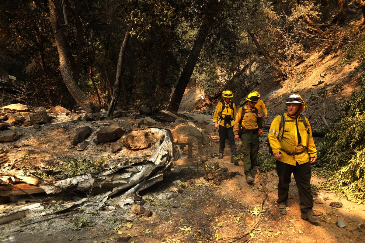
As weather conditions improve, firefighters make progress battling Southern California wildfires

- Share via
Cooling weather gave firefighters a boost Saturday in their battle against three large Southern California wildfires that have scorched more than 100,000 acres, displaced thousands of residents in mountain communities and burned dozens of homes.
The largest of the blazes, the week-old Bridge fire, forced thousands to flee as it ripped through Mount Baldy Village and Mountain High ski resort, consuming nearly 53,000 acres in the San Gabriel Mountains in Los Angeles and San Bernardino counties. At least 33 homes were destroyed. Evacuations largely remain in effect.
Farther east and south, firefighters were gaining more control. Evacuation orders were beginning to lift for the arson-sparked Line fire, which has chewed through 38,000 acres in the San Bernardino Mountains between Highland and Big Bear Lake.
The Airport fire swept through 23,000 acres in Orange and Riverside counties and destroyed 89 homes and two businesses.
“The cooler weather and higher relative humidity are allowing firefighters to increase these containment lines,” said Orange County Fire Authority Capt. Steve Concialdi, who was working the Airport fire.
“We are making significant progress. We do not believe the fire will get any bigger.”
An incoming cold front and cloudy weather this weekend are expected to bring more reprieve, officials said Saturday. Much of Southern California saw temperatures ranging from the high 60s to mid-70s throughout the day.
Many parts of the region are expected to see a double-digit drop in temperatures, extensive cloud cover and a chance for light rain over the next few days, according to the National Weather Service. In one of the most drastic swings, downtown Los Angeles is forecast to see high temperatures in the low 70s, a nearly 40-degree drop from its high of 112 degrees Sept. 6. There is even a slight chance for light rain Wednesday and Thursday.
These milder conditions — along with increased humidity — are also expected to extend farther inland near the wildfires.
“As we’ve seen the last few days, there’s been a pretty good cooling trend from the excessive heat wave that we saw persist for almost a week,” National Weather Service meteorologist Bryan Lewis said. “This provides some really nice relief, especially after these fires have been going out of control.”
The California Department of Forestry and Fire Protection credited high moisture levels with slowing the Line fire, which was 29% contained as of Saturday but continued to creep into dry vegetation while making occasional runs along slopes. Favorable wind conditions also helped keep the Bridge fire — the largest active wildfire in California — within its current footprint, but it remained only 5% contained Saturday. The Airport fire was only 19% contained.
Patchy fog and drizzling rain could help firefighters in these hot spots as well.
“We’re calling it more of a drizzle to light rain,” Lewis said. “That’ll likely impact these lower-elevation areas. It’ll help dampen the fuels and potentially help put out some of the smaller spot fires.”
Meanwhile, communities stretching from the San Gabriel Mountains to Lake Elsinore remain under a smoke advisory from the South Coast Air Quality Management District. The air district has encouraged residents to take precautions to protect themselves from dangerous levels of air pollution, including remaining indoors and keeping windows closed as wildfires have released large plumes of smoke and ash, which continue to hover over nearby communities.
Last week, several air monitors in the Inland Empire detected fine-particulate pollution levels above the federal health limits, including Riverside, Ontario and Fontana. An air monitor in Big Bear City recorded the highest level with a daily average of 372 parts per million, more than 10 times higher than the federal health standard.
The pollution has eased in many areas. However, communities in the San Gabriel and San Bernardino mountains were still experiencing unhealthful air quality, according to the air district.
More to Read
Sign up for Essential California
The most important California stories and recommendations in your inbox every morning.
You may occasionally receive promotional content from the Los Angeles Times.


