How do you track an atmospheric river? Climb aboard this highflying reconnaissance jet
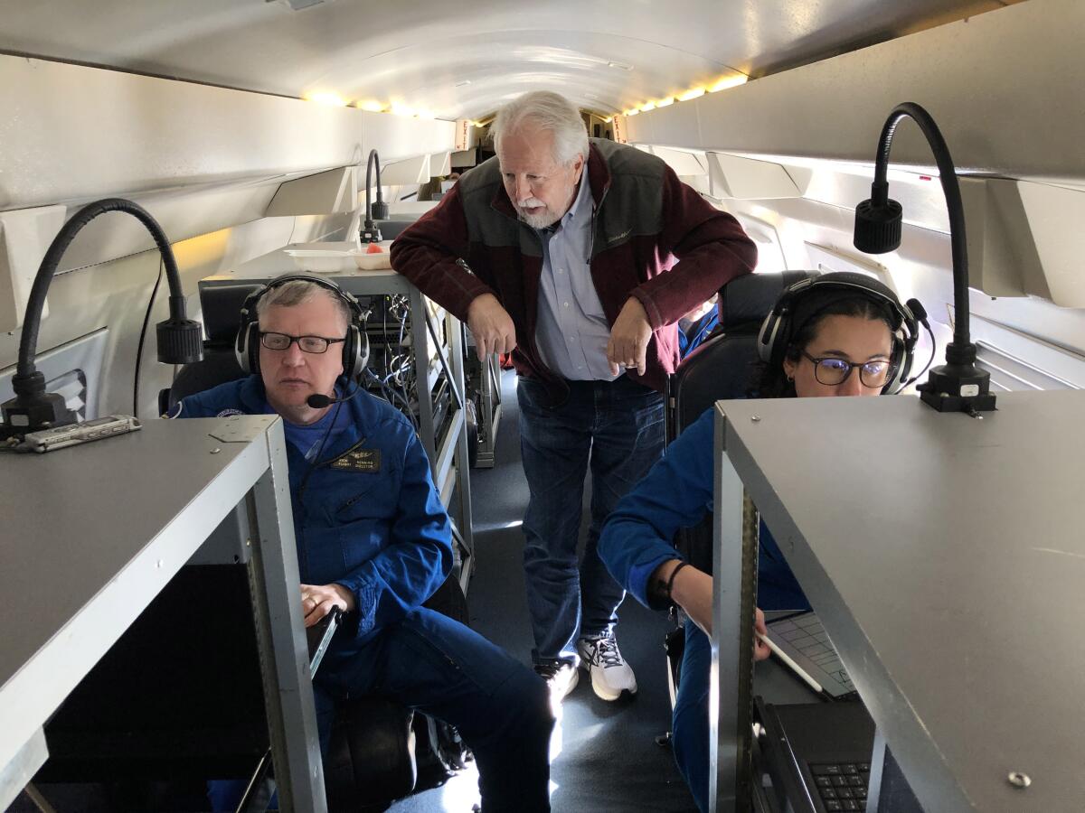
The interior of the plane looked like a cross between a private luxury jet and a space mission control room.
The Gulfstream IV cruised at 43,000 feet, high above a seemingly peaceful layer of thick clouds that stretched to the horizon.
Crew members in blue jumpsuits stared at computer screens that revealed their hidden target miles below: a powerful atmospheric river that was churning across the Pacific Ocean toward California, bearing torrential rains and fierce winds.
Soaring more than 1,000 miles northeast of Hawaii, the specially equipped hurricane-reconnaissance jet “Gonzo” was preparing to drop dozens of data-collecting devices into the heart of the storm. By capturing the equivalent of a CT scan, the crew would help to predict when and where the rains would hit. And how hard.
Meteorologists on board a specially equipped hurricane-reconnaissance jet were trying to answer one question: How bad would the next atmospheric river be?
The extreme weather specialists with the National Oceanic and Atmospheric Administration were on their eighth straight mission tracking the series of January storms that unleashed deadly flooding and widespread damage across the state.
The flights have become critical to preparing for floods and getting people out of harm’s way, said Marty Ralph, a meteorologist who joined the crew as a special guest on the mission.
Ralph has helped pioneer research of atmospheric rivers, or as the experts call them, ARs. He said the flights have become essential for improving forecasts and managing reservoirs and water supplies in this age of extreme weather swings.
“ARs are the big storm for water in the West,” Ralph said. “We are doing reconnaissance to measure these storms, and precisely get the data into the weather prediction models.”
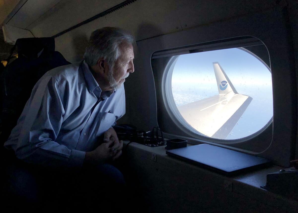
Ralph, who leads the Center for Western Weather and Water Extremes at UC San Diego’s Scripps Institution of Oceanography, said the mission would be nothing like flying through the eye of a hurricane. The plane would remain high above the storm, while the atmospheric river, shrouded in clouds, churned away at an altitude of about 10,000 feet.
“It’s well below us. But we’ve got the tools and sensors to see into that,” he said.
Research has shown that atmospheric rivers transport, on average, more than twice the flow of the Amazon River into the Atlantic Ocean.
“And this is a strong one. So it’s going to be much bigger than that,” Ralph said. “It is pumping water vapor like you can’t imagine.”
Up until a couple of decades ago, few people had heard of atmospheric rivers — vast streams of vapor sailing above the world’s oceans outside the tropics.
Today, they are recognized as the storms that deliver much of the water in California and the arid West, and their presence or absence can mean the difference between drought or flooding.
Driven by strong, low-altitude winds, they develop over the Pacific and build as they travel for two to five days toward the West Coast. They transport moisture in concentrated bands, often between 100 miles and 500 miles wide, and can stretch 2,000 miles.
The latest storms arrived after California’s three driest years on record, significantly boosting reservoir levels and blanketing the Sierra Nevada with the deepest snow in years.
Scientists project that atmospheric rivers will grow more potent as temperatures rise because of global warming, and will become an even more dominant driver of California’s water supplies and flooding.
“Climate change is adding more water vapor to the air because warmer air can hold more water vapor. And water vapor is the fuel of an AR. So it’s going to be making some ARs stronger,” Ralph said. “However, there’s also an expectation that there will be longer dry periods between ARs.”
All of which will complicate water management in California and the West.
Reservoirs and traditional water management methods are “largely designed for the past climate,” Ralph said. “But we have to deal with the future.”
Gonzo has a specialized radar system for approaching storms, requiring an elongated nose that gives the plane its nickname. An image of the Muppet character is emblazoned on the side of the plane. The jet also has a separate Doppler radar system in the tail, which captures cross-section images as it passes over a storm.
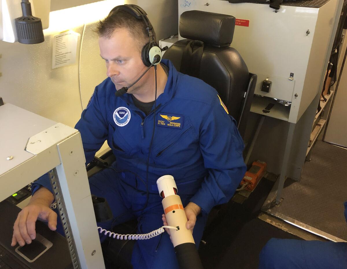
As the aircraft approached the atmospheric river, two crew members removed shiny silver wrapping from the first of dozens of cylinders. Each measured 16 inches long and nearly 3 inches wide and resembled an oversized tube of Pringles.
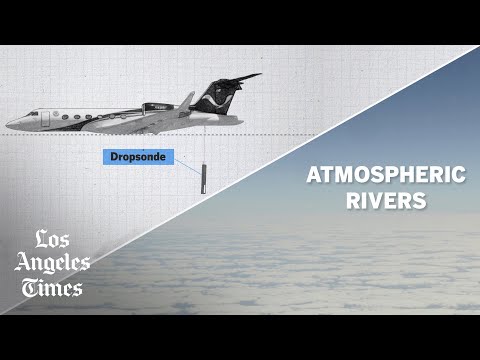
The devices, called dropsondes, are equipped with parachutes and as they descend transmit data back to the plane — wind speed and direction, temperature and humidity — before hitting the ocean and sinking.
Rocky Weinmann, a technician, held a dropsonde and plugged a cord into the device to activate it. A green light flashed. Weinmann jotted down its serial number, and a colleague placed it into a launch tube behind his seat, then closed the hatch.
“We’re just about to launch,” Weinmann said.
The crew planned to drop 30 “sonds,” as they called them, over a precise set of coordinates.
Speaking quietly into his headset, meteorologist Rich Henning signaled to colleagues at the back of the plane that it was almost time.
“About one minute.”
“Stand by.”
Then, he gave the word: “Release sond now.”
Weinmann flicked a red switch. There was a whoosh of air as the spring-loaded gate valve opened. The pressurized air from the cabin pushed the dropsonde out into the thin atmosphere, and the device fell toward the clouds.
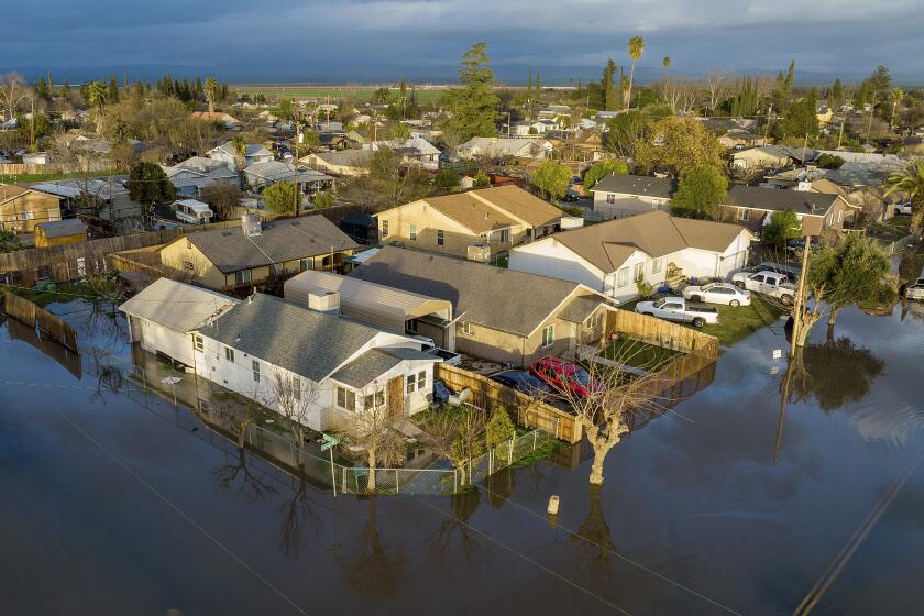
A new state plan for the Central Valley calls for spending as much as $30 billion over 30 years to prepare for the dangers.
There was no way to see the dropsonde launch. But it instantly began transmitting data.
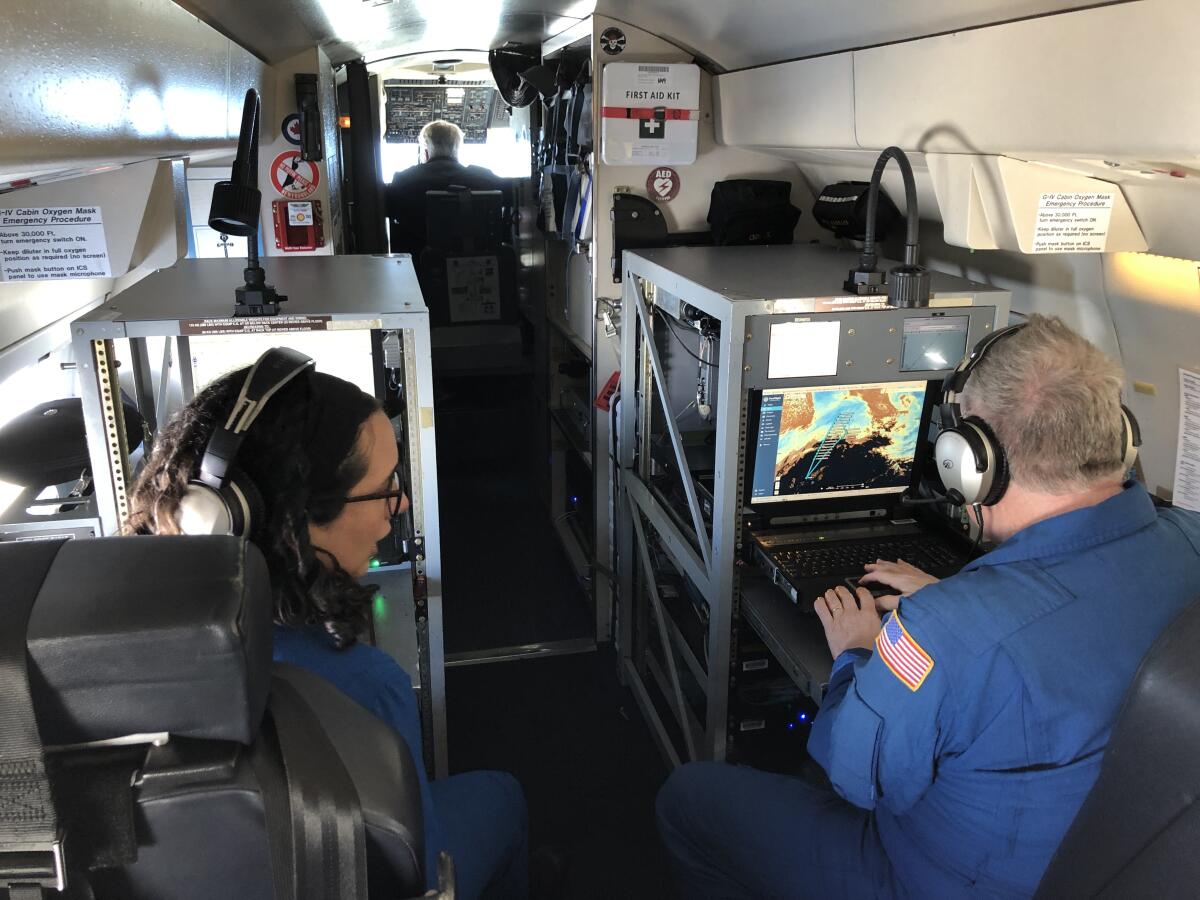
Sofia de Solo, a meteorologist, watched the measurements appear on her monitor as four distinct lines.
“The blue one is our relative humidity,” De Solo said. “The green one is temperature. The red one is your wind direction, and your pink one, magenta one is your wind velocity.”
Once she checked the data, she transmitted them via satellite and the measurements flowed into computer models that feed weather forecasts.
The dropsondes recorded high-altitude winds of up to 190 mph. Lower down, within the storm, the winds were pushing water vapor at speeds of up to 90 mph.
As the jet cruised above the clouds, De Solo saw the atmospheric river’s signature appear in the data. Two lines tracking dew point and temperature converged. The radar detected heavy rains beneath the clouds.
“It’s essentially as moist as it can get,” De Solo said. “For the bottom 10,000 feet, we have total saturation. So it’s a pretty classic atmospheric river.”
After examining the data, Ralph stepped into the cockpit and sat chatting with co-pilot Rick de Triquet. Looking out the window, Ralph said he had briefly seen through holes in the clouds, which revealed what looked like whitecaps rolling on the stormy ocean.
Aside from those brief glimpses through the storm, the cirrus clouds resembled a flat blanket beneath the deep blue sky.
“ARs sort of hide in plain sight,” Ralph said. “And we’ve just recently, in the last 10 or 15 years, figured out really how to look for them, how to measure them best and how to characterize them.”
The science of atmospheric rivers has come a long way since Ralph and his colleagues published a 2004 study drawing on data from satellites and reconnaissance flights. Since then, Ralph said, more than 500 articles have been published in scientific journals with titles focusing on atmospheric rivers.
The concept of atmospheric rivers began to emerge in the 1970s, when research in the U.K. showed that a low-level jet stream ahead of a cold front was connected to heavy rains in Britain.
Decades ago, Ralph was fascinated with big, drenching storms even before he heard the term atmospheric rivers. As a graduate student at UCLA in 1990, he was astonished when a sudden storm dumped a large share of L.A.’s average annual rainfall in his rain gauge within about six hours.
In 1998, scientists published a groundbreaking paper detailing the “moisture fluxes from atmospheric rivers.” Ralph said when he read the research, “that was a lightbulb going off for me.”
That year, Ralph had begun flying to storms aboard NOAA planes during a powerful El Niño event. Taking off from Monterey, he and other researchers flew directly into the storms and collected measurements. They shared the data with the National Weather Service, which issued a flash flood warning, prompting emergency managers to send rescue workers ahead of the storm to low-lying areas around Santa Cruz.
Experts say California’s recent series of storms was no more severe than what the state has experienced in the last century.
“They did hundreds of water rescues when that storm hit the next day. And they attributed the early warning to saving many lives,” Ralph said. “That really inspired me personally to consider: How could we do more of that?”
Since then, Ralph has sought to encourage more research and raise awareness. In 2013, he started the center at Scripps focusing on western weather and water extremes.
Scientists have found that even an average AR transports as much water vapor as 25 times the flow rate of the Mississippi River into the Gulf of Mexico. And they’ve studied ARs around the world, from Europe to South America.
Working with other scientists, Ralph helped develop an official definition of atmospheric rivers and created a scale to rate the strength of ARs, from 1 (weak) to 5 (exceptional). Along with ARs, the meteorologists speak of IVT, or integrated vapor transport. This key measurement refers to how much water vapor is moving through the atmosphere and how fast it is traveling.
Ralph has helped lead the expanding national effort to have planes flying to the storms, called the Atmospheric Rivers Reconnaissance program.
The seven crew members on this flight are part of a NOAA team from Lakeland, Fla. They fly into hurricanes for part of the year, and then travel to Hawaii for atmospheric rivers.
On his screen, Henning followed the measurements that appeared in curving lines as two dropsondes floated down. Each would be in the air for about 14 minutes.
His screen showed the plane’s position on a map as it advanced toward the next drop location. Another dropsonde was activated and inserted into the launch tube.
“Five minutes.”
“Three minutes.”
Satellite images from Jan. 5 to Jan. 14 show a series of atmospheric rivers bringing rain to the West Coast. (Cooperative Institute for Research in the Atmosphere at Colorado State University and NOAA; Sean Greene / Los Angeles Times)
The AR Recon program began with a trial effort in 2016, when Air Force C-130s flew to storms for three weeks.
The following year, while Ralph and his colleagues were still studying data from those flights, a series of atmospheric rivers made it the wettest year on record in Northern California. Lake Oroville reached full capacity and when water was released, part of the spillway collapsed at Oroville Dam, triggering a crisis and prompting evacuations.
“How could we maybe have done better? Well, first of all, we could have been flying AR recon. We were not flying AR recon that winter,” Ralph said. “I’ll never forget that that decision was made, and I regret it.”
The AR Recon program has expanded over the last few years. This year, while the NOAA crew has been flying out of Hawaii, the Air Force Reserve 53rd Weather Reconnaissance Squadron has been flying a C-130 from California to scan other parts of the storms.
Studies have shown the flights are making forecasts significantly more accurate. On average, Ralph said, the additional data have improved precipitation forecasts by about 20%.
This is allowing California to begin to operate dams more flexibly, guiding decisions to release water to make room for deluges, or to hold extra water when no major storm is coming.
The effort, which involves multiple water agencies, is called Forecast-Informed Reservoir Operations, and the places where it’s been implemented include Lake Mendocino in Northern California and Prado Dam in Riverside County.
“It’s working,” Ralph said. “We’re making a difference in the forecasts for the public.”
About 95% of the water that flowed into the Sacramento-San Joaquin River Delta in the first two weeks of January ended up in the Pacific Ocean. Here’s why.
On this flight, the data showed the atmospheric river was slightly weaker than the computer models had forecast.
Ralph and others hope to further expand the program so that crews and planes will be available to fly from Nov. 1 through March, starting in a month that overlaps with the end of the Atlantic hurricane season but when intense atmospheric rivers have struck the Pacific Northwest.
Ralph and De Triquet chatted excitedly about a new Gulfstream G550 that NOAA is set to receive, a plane that can fly longer distances than Gonzo. Ralph said he thinks the jet will further improve forecasts by covering more territory.
After more than six hours in the air, the plane returned to Honolulu and touched down under sunny skies.
Ralph thanked the crew, saying they are doing vital work protecting the public and making a “major contribution to Western water.”
“This isn’t something that satellites are going to replace, or something that we can do if we sort of feel like it. I think this is becoming a national requirement,” Ralph said.
The storm reached Southern California over the next two days as a strong Category 3 AR, just as predicted.
By that time, the crew was flying over the Pacific again, headed to another atmospheric river.
