Delta Conveyance Project proposed path
Detailed
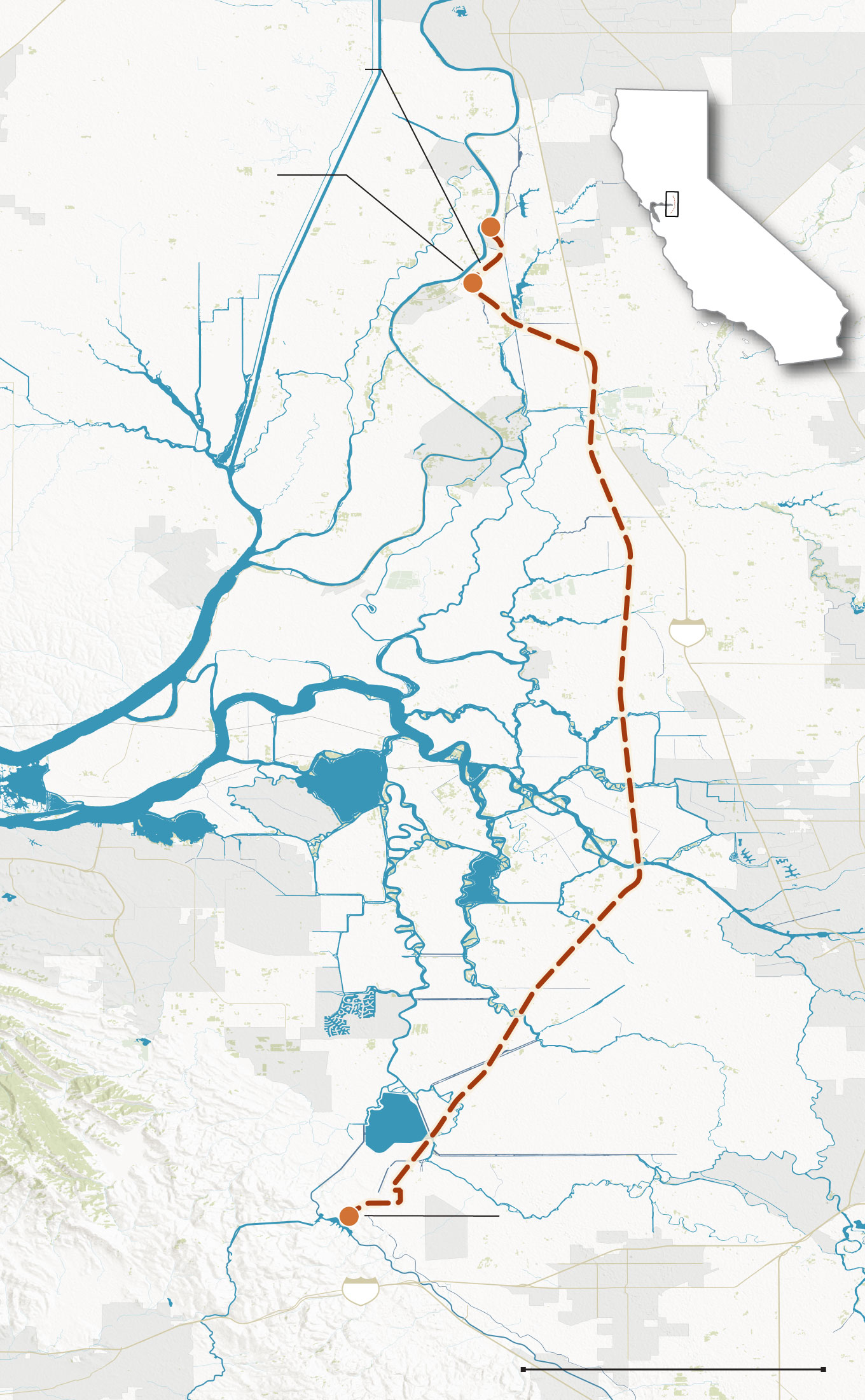
Delta Conveyance Project
proposed path
Sacramento
Two intake valves on the Sacramento River would pump water into the tunnel to move south
Sacramento
River
Detailed
Hood
Courtland
Cosumnes
River
Locke
Mokelumne River
Rio
Vista
5
San Joaquin River
Bethel
Island
Big Break
Oakley
Antioch
Stockton
Discovery
Bay
Middle River
Clifton Court
Forebay
After 45 miles, water would be discharged into Bethany Reservoir before entering the California Aqueduct
Bethany
Reservoir
California
Aqueduct
580
Tracy
South Bay
Aqueduct
10 MILES
Livermore
10 MILES
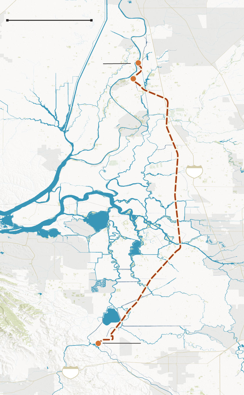
Sacramento
Sacramento
River
Two intake valves on the Sacramento River would pump water into the tunnel to move south
Hood
Courtland
Locke
Rio
Vista
5
San Joaquin River
Oakley
Antioch
Stockton
Discovery
Bay
Clifton Court
Forebay
After 45 miles, water would be discharged into Bethany Reservoir before entering the California Aqueduct
Bethany
Reservoir
California
Aqueduct
580
Livermore
California Department of Water Resources, USGS, U.S. Census Bureau, OpenStreetMap
Sean Greene LOS ANGELES TIMES