Satellite photos of the Kincade fire threatening California’s vineyards
The Kincade fire, which broke out Wednesday night, has burned 21,900 acres in northern Sonoma County and was only 5% contained as of Friday morning.

The blaze has been fueled by dry, strong winds topping 70 mph and high temperatures. The entire town of Geyserville and nearby vineyards in the region were forced to evacuate as the fire burned out of control.
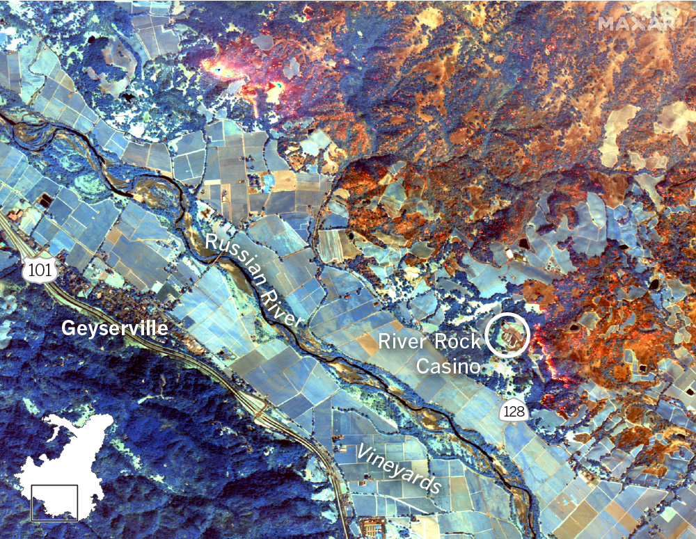
New satellite imagery of the fire shows just how close the blaze is to Geyserville and the vineyards nearby. Fire officials stated that 49 structures have been destroyed so far.
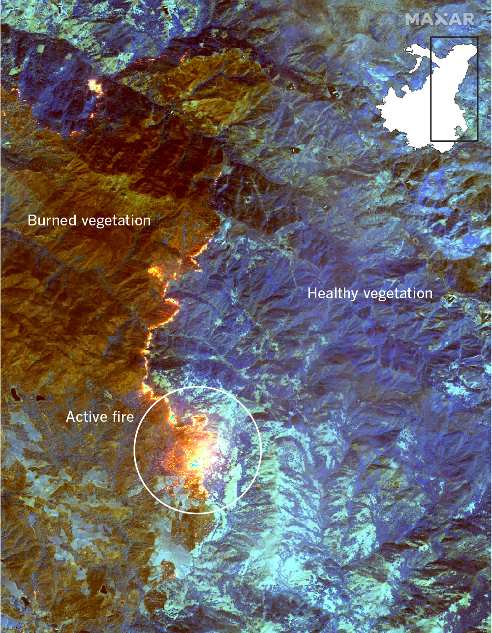
An infrared view shows the fire’s spread
Imagery from the WorldView-3 satellite shows the western edge of the Kincade fire as it burns close to Geyserville. The images use shortwave infrared sensors to show where the fire has burned near the town.

A closer look at the image shows the fire’s proximity to several vineyards in Geyserville, as well as the River Rock Casino.
The eastern edge of the fire is burning into more sparsely-populated mountain areas. Several active fire spots are visible.
The dry winds that fueled much of the fire’s original growth are expected to slow down on Friday, but are forecast to pick up over the weekend. According to NWS forecasters, winds could reach speeds up to 80 to 85 miles per hour on Sunday in the Kincade fire area, creating similar conditions to the ones that fueled the deadly wine country fires in 2017.
More fire coverage:
Map: Where PG&E may shut off power to customers
Tick fire explodes overnight: 14 Freeway closed, six homes destroyed as battle intensifies
As Kincade fire rages, Northern California faces biggest blackouts ever this weekend