
Before and after: Where the Thomas fire destroyed buildings in Ventura
UPDATED Dec. 11
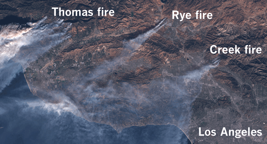
A series of Santa Ana wind-driven wildfires raging across Southern California have destroyed at least 1,000 structures, forcing thousands to flee and filling the region with smoke. Much of the reported structural damage has been in Ventura County. Satellite imagery revealed the destruction the fires left behind, with more than 400 buildings destroyed in a neighborhood in the city of Ventura.
Thomas fire
A fire that started Dec. 4 near Ventura has destroyed hundreds of homes and threatened thousands more. Driven by Santa Ana winds, the Thomas fire was 15% contained Monday afternoon.

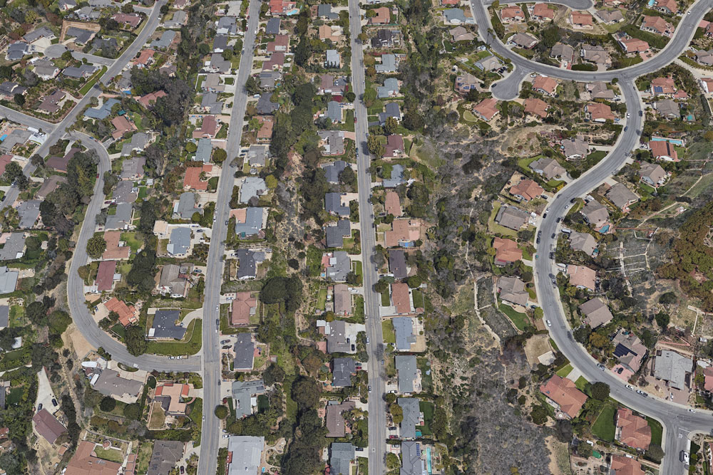
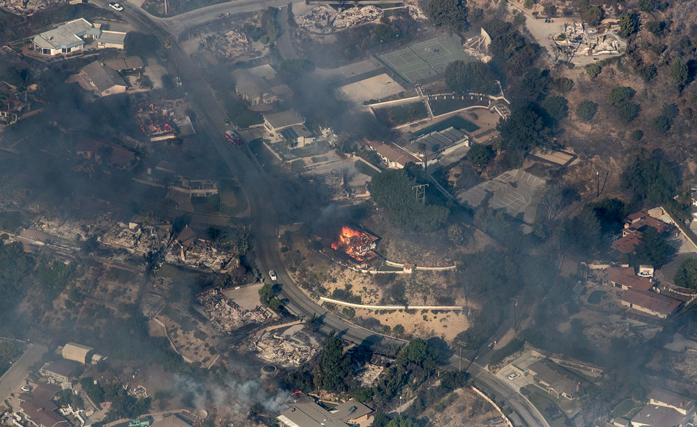
A neighborhood on the north side of the city of Ventura was heavily damaged. Using satellite imagery provided by Digital Globe, the Times identified more than 400 buildings that were destroyed by the fire.


Via Ondulando and Colina Vista
The fire started northeast of Ventura and spread through a largely uninhabited mountainous area before reaching the city. Via Ondulando and Colina Vista, streets in the foothills on the northern edge of Ventura, suffered extreme damage, with many houses leveled in the blaze.

Oct. 2016
Dec. 5, 2017

Nob Hill Lane
A few streets over on Nob Hill Lane, the scene was similar — most houses burned to the ground, with a few left intact.

Oct. 2016

Dec. 5, 2017
Scenic Way Drive
Nearly every home on Scenic Way Drive was destroyed. The vegetation in the canyon to the east of the road was blackened by the fire.

Oct. 2016

Dec. 5, 2017

Lilac fire
Another brush fire fueled by Santa Ana winds began in San Diego County on Thursday, quickly growing to over 4,100 acres with 0% containment as of Friday morning. The fire prompted mandatory evacuations across the northern part of the county, threatening over 5,000 structures and destroyed at least 20.

Rancho Monsurate Country Club
The wind-driven fire ripped through Rancho Monsurate Country Club, a retirement community in Fallbrook. Imagery from the following day shows several houses completely destroyed in the tightly-built community just west of the 15 freeway.

Nov. 2016

Dec. 8, 2017

This page will be updated as more information and imagery becomes available.
Dec. 8, 12:40 p.m.: This article was updated to include information about the Lilac fire.
Dec. 11, 6 p.m.: This article was updated to include buildings destroyed by the Thomas fire.
Credits: Additional reporting by Jon Schleuss