(Lively Scout / For The Times
)
)
The five best winter hikes you can do right now
- Share via
This is the year you will tighten your bond with nature to be ready for whatever 2022 throws at you, right? Hiking is a good way to begin. There are plenty of Southern California trails to hike in winter where you won’t have to deal with snow and ice. Here are five that are perfect for cooler months.
Showing Places
(Mary Forgione / Los Angeles Times)
Escondido Falls
Malibu Urban Trail
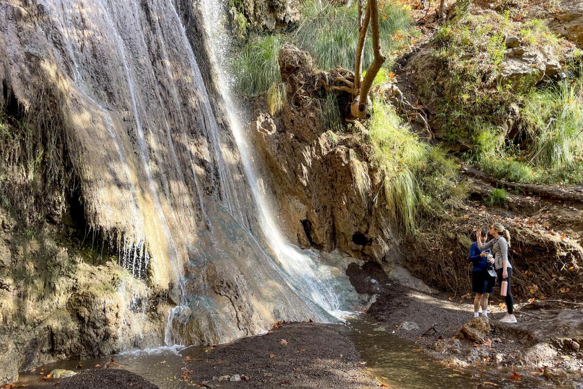
Aren’t waterfalls best on a hot summer day? Maybe, but Southern California’s enduring drought has turned that notion on its head. The falls hidden behind a posh Malibu neighborhood were reduced to barely a trickle last summer. That’s all different now. Recent rains have sent two sets of falls churning. You can walk right up to the lower 50-foot falls (but don’t get too close); the higher falls are accessible only by a steep, narrow trail lined with a rope. It can get muddy in the narrow canyon; I counted four stream crossings on a recent hike. And don’t let the luxury homes at the “trailhead” put you off. Walk almost a mile on pavement before descending to the Eddie Albert Escondido Canyon Trail and Waterfalls and follow the wide path.
The start: Escondido Canyon Park, 27200 Winding Way. Malibu. Very limited parking in $12 lot; street parking available on Pacific Coast Highway.
The start: Escondido Canyon Park, 27200 Winding Way. Malibu. Very limited parking in $12 lot; street parking available on Pacific Coast Highway.
Read All Read Less
Route Details
(Mary Forgione / Los Angeles Times)
Mission Point
Granada Hills Urban Trail
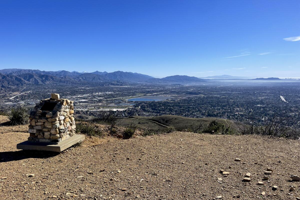
The trek to Mission Point can be grueling in summer. In winter, the hike to the 2,771-foot peak offers some of the best clear, wind-swept views of the San Fernando Valley, Downtown L.A. and eye-level views of sandstone walls. Start on the main paved trail from O’Melveny Park up Bee Canyon under sycamore and oak trees. The trail turns to dirt and approaches a lookout with a bench less than a mile from the start. After that, the wide fire road seems to wind ever uphill. Parts of the trail are heavily eroded but passable (resist taking the trail cuts that go straight up and down). At the top, you’ll see a stone marker with a plaque dedicated to Dr. Mario A. DeCampos, a mountaineer who “cherished Mission Peak.” Retrace your steps and savor the views all the way down.
The start: O’Melveny Park, 17300 Sesnon Blvd., Granada Hills; bathrooms; free parking in lot or on street.
The start: O’Melveny Park, 17300 Sesnon Blvd., Granada Hills; bathrooms; free parking in lot or on street.
Read All Read Less
Route Details
Mt Lukens.
(Joan Schipper/@cashiostreet)
Mt. Lukens
Tujunga Mountain Trail
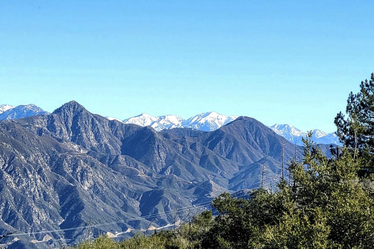
Mt. Lukens is not a pretty peak. The western-most peak in the San Gabriels is studded with communication towers, each contained by a chain link fence. Still, there are good reasons to hike to it in winter. The views, for starters. Looking south, you see the sprawl of Glendale and the Verdugo Mountains; looking north, you peer into the backcountry of the San Gabriels, which right now happen to be frosted with snow. Also, you can claim bragging rights that you hiked to the highest point in Los Angeles (5,064 feet in elevation). Make a loop starting up the Rim of the World Trail and descending on the Crescenta View Trail.
The start: Deukmejian Wilderness Park, 3429 Markridge Road, Glendale. Free parking; bathrooms at trailhead.
The start: Deukmejian Wilderness Park, 3429 Markridge Road, Glendale. Free parking; bathrooms at trailhead.
Read All Read Less
Route Details
(Charles Fleming)
Sandstone Peak
Malibu Mountain Trail
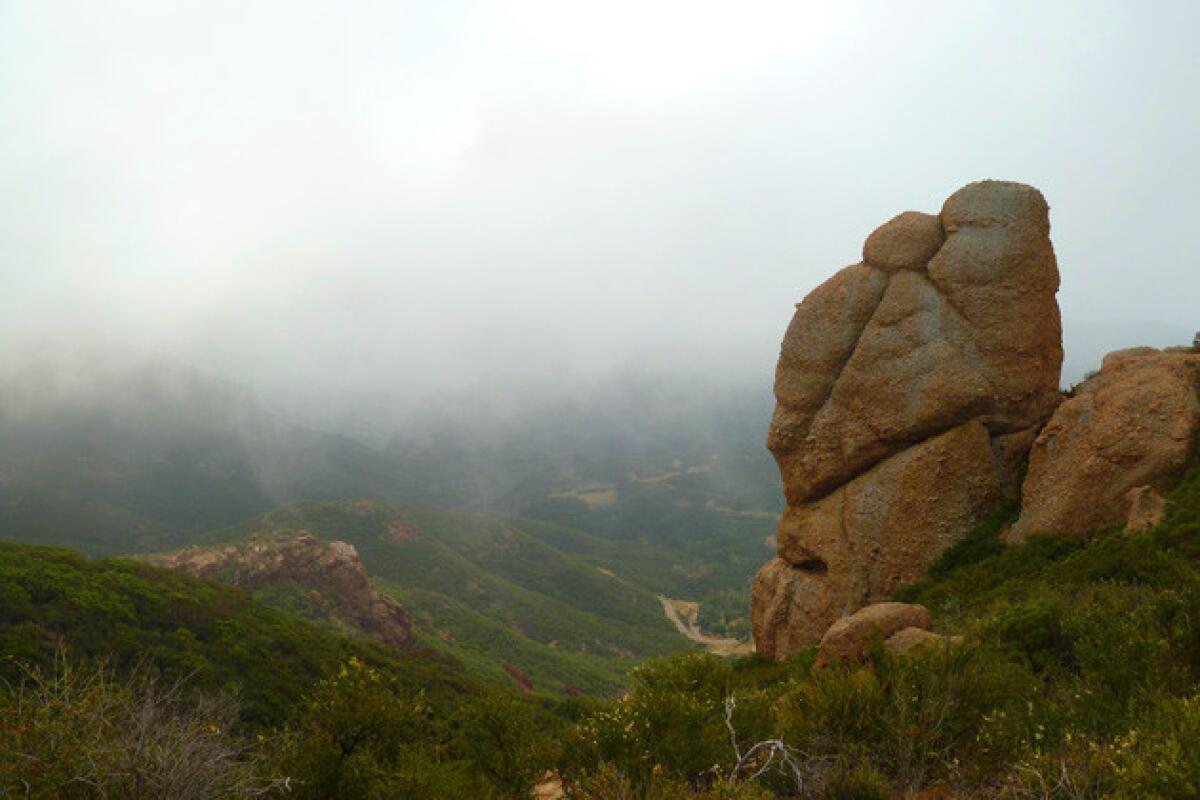
Cool winter temperatures mean you don’t need to carry gallons of water for a day hike to one of the standout peaks in the Santa Monica Mountains. At 3,114 feet in elevation, Sandstone is the highest point in the range — with fantastic views of the surrounding coastal mountains and the Pacific Ocean. The trail winds through stretches of scrub oak and chaparral to Split Rock (yep, you can walk through) and red-rock outcroppings like Balanced Rock, which leave you feeling as if you’ve been transported to the Southwest. You can do this as an out-and-back or a longer loop, depending on how fit you feel. Start at the Mishe Mokwa Trail, a name that comes from “The Song of Hiawatha” by Henry Wadsworth Longfellow (though I don’t know how that name landed here).
The start: Mishe Mokwa Trail, 1.75 miles north of the Circle X Ranch along Yerba Buena Road in Malibu. Free parking in dirt lot.
The start: Mishe Mokwa Trail, 1.75 miles north of the Circle X Ranch along Yerba Buena Road in Malibu. Free parking in dirt lot.
Read All Read Less
Route Details
(Mary Forgione / Los Angeles Times)
The Ultimate Destination Vista Point
La Cañada Flintridge Urban Trail
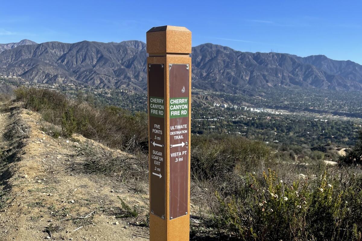
Who could resist a trek to something called the Ultimate Destination? That is the name of a lookout in Cherry Canyon Park above Descanso Gardens in La Cañada Flintridge. Go for views of the San Gabriel Mountains, the inviting picnic tables, the water fountain and scrub oaks that dot the lookout point. The hike covers wide fire roads that are easy to follow. Take the Cherry Canyon Motorway to Five Points and then the Ridge Motorway to the Ultimate Destination and return the same way you came. Fire roads in summer can be hot and dusty; a winter hike allows you to savor the views and skip the heat.
The start: Hampstead Road and Cherry Canyon Motorway in La Cañada Flintridge; free parking in lot or on street.
The start: Hampstead Road and Cherry Canyon Motorway in La Cañada Flintridge; free parking in lot or on street.
Read All Read Less
Route Details
Sign up for The Wild
We’ll help you find the best places to hike, bike and run, as well as the perfect silent spots for meditation and yoga.
You may occasionally receive promotional content from the Los Angeles Times.
