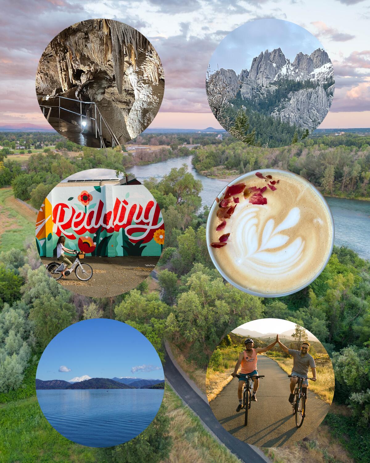
This under-the-radar city is the hiking trails capital of California
- Share via
Redding doesn’t get talked about much as a travel destination. That’s because what makes Redding worth a trip is everything else that surrounds Redding.
The northeastern California city is an ideal home base for exploring Shasta Cascade, an area filled with natural wonders. Trek a mile from downtown Redding and you can be kayaking on the Sacramento River. Drive 15 minutes west and you’re swimming or water-skiing in Whiskeytown Lake. From there, head slightly south and you’re hiking or mountain biking toward a cascading waterfall in Whiskeytown National Recreation Area. Or drive east and you’re walking next to geothermal springs and mud pots at Lassen Volcanic National Park.
Planning your weekend?
Stay up to date on the best things to do, see and eat in L.A.
With 225 miles of trails within just a 15-mile radius of its downtown, Redding has been called the “trails capital of California,” so it makes sense that it is the headquarters of American Trails, an organization that ensures trails and greenways around the country are well-maintained and accessible.
Once the home of the Wintu people, the city got its name from Benjamin B. Redding, a Sacramento politician who bought property in the area on behalf of the Central Pacific Railroad in 1868. This happened during the Gold Rush, but Redding didn’t have any gold. Because of that, the area was originally called Poverty Flats, but a railroad station was built here and led to the development of the town. Redding’s growth was later spurred by the copper and iron mining industry, the construction of the Shasta dam and the lumber industry.
The temperature in Redding can rise above 100 degrees in the summer (being the sunniest city in California has its downside — Redding is sunny 88% of the year), but thankfully it’s not just about the hiking and biking trails here. With Whiskeytown Lake, Lake Shasta, the Sacramento River, not to mention the various waterfalls and creeks, there are many ways to get on and in the water to cool down.
One weekend isn’t enough here: You can spend a day paddling around the lakes, another day chasing waterfalls, and another biking along the river and you still would barely scratch the surface of what the area has to offer.
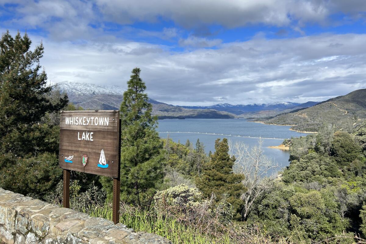
Take a dip in Whiskeytown Lake
The lake is a mere 15-minute drive from downtown Redding, so it’s an easy spot to head to for a dip in the cool water on those 100-degree days. There are two sandy beaches around the 5-square-mile lake and plenty of places to launch a kayak or paddleboard. In the summer, you can also take a ranger-led kayak or paddleboard tour. Reservations required.
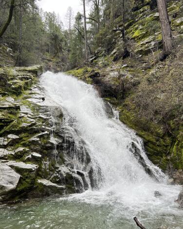
Trek through a forest to Whiskeytown Falls
To reach the waterfall, take the James K. Carr Trail, which starts from a small parking lot on Crystal Creek Road. While it’s only a 3.4-mile round trip, it’s not an easy hike with its 700-feet elevation gain. The trail is mostly shady, at least, and the air cools down noticeably once you approach the waterfall. From the base of the waterfall, there is a set of stairs to the left that leads up to an upper viewing platform.
For those looking for an easier waterfall to get to, the cascading Crystal Creek Falls is accessible via a one-mile flat, paved, wheelchair-friendly trail.
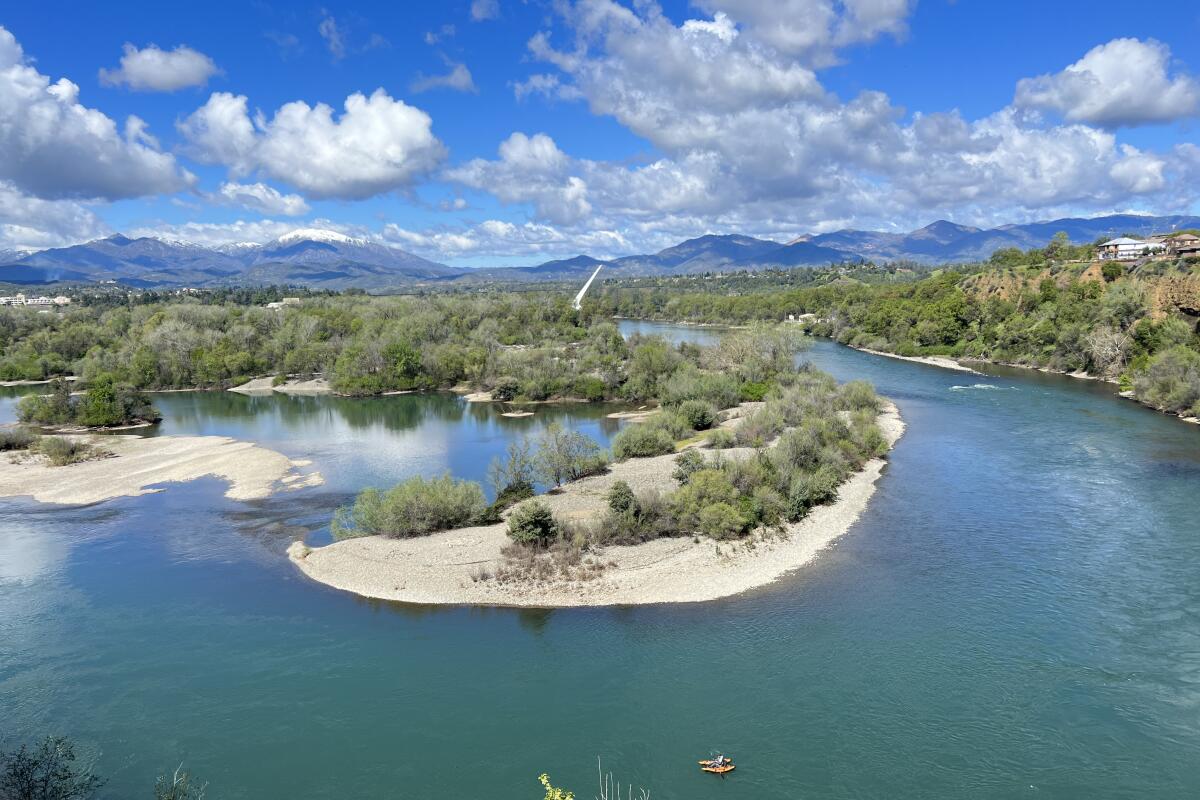
Paddle down the gorgeous Sacramento River
The easiest and cheapest way to get in a scenic paddle on the river is to book a two-hour guided raft tour through North County Raft Rental (tours start at $29 per person). Alternatively, kayakers can rent from Action Sports Rentals, which offers drop-off and pick-up service for an extra charge. Kayak renters would typically start at the Sundial Bridge and paddle downstream to one of the pickup points, which are about a two-hour paddle from each other.
Note that there are some minor rapids (Category I) on the Sacramento River, so kayaking newbies can opt to rent from Headwaters Adventure and paddle around the much more tranquil Kutras Lake instead.
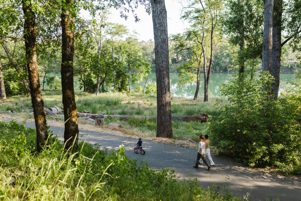
Bike along the scenic Sacramento River Trail
The Sacramento River Trail is paved and mostly flat, but there are some inclines that provide a decent workout. The trail is open for pedestrians, bicycles and e-bikes. Visitors can rent bikes through the bikeshare program or e-bikes at the local Pedego shop (marked on this map).
Although the trail spans 17.4 miles and the local Pedego shop owner assured me that one e-bike charge is enough to ride to the Shasta Dam and back, there is a loop around the river that makes for a much easier and shorter ride. The Diestelhorst Bridge and the Stress Ribbon Bridge connect the two sides of the river for a 5.5-mile loop. On the other hand, the Sacramento River Trail also provides access to a network of over 200 miles of trails.
If mountain biking is more your speed, head to Chamise Peak Trail. The 5.5-mile round-trip trail is both dog- and mountain bike-friendly, and promises views of all the major landmarks: Sacramento River, Shasta Dam, Lake Shasta and Mt. Shasta.
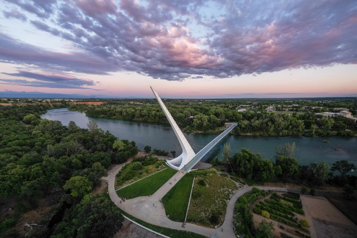
Spot the iconic Sundial Bridge at Turtle Bay Exploration Park
The museum houses an aquarium, which displays the common fish and habitat of the Sacramento River, an exhibit about the Wintu people who have lived in the region for centuries, as well as exhibits about the surrounding landmarks from the Shasta Dam to Shasta Caverns. A short walk from the museum is a forest-themed playground and orphaned animals living in natural enclosures.
On the other side of the river you’ll find McConnell Arboretum & Botanical Gardens with a leisurely one-mile loop that connects to the Sacramento River Trail.
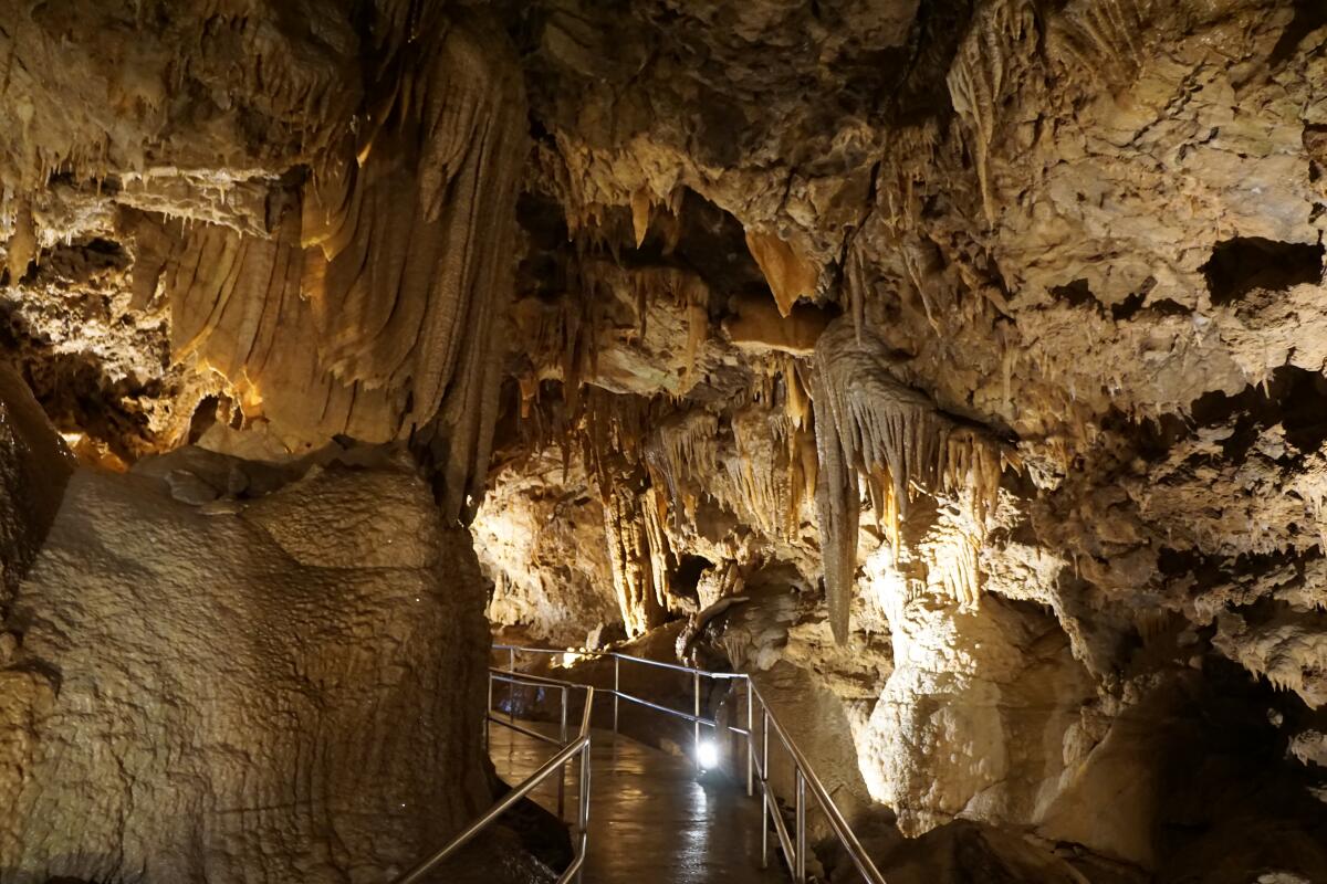
Ride a boat to Lake Shasta Caverns
To reach the caverns, you’ll have to cross the lake on a boat and then hop on a bus for a steep ride up to the entrance. As a bonus, the waiting room by the entrance comes with a great bird’s-eye view of Lake Shasta. Inside the caverns, draping curtains of limestone and stalactites hang from above.
Since the caverns are always at roughly the same temperature, the cavern tour also acts as a popular respite from the heat in the hotter months so advance reservations would be wise. Note that touring the caverns involves a lot of stairs — around 350 steps up and 250 steps down.
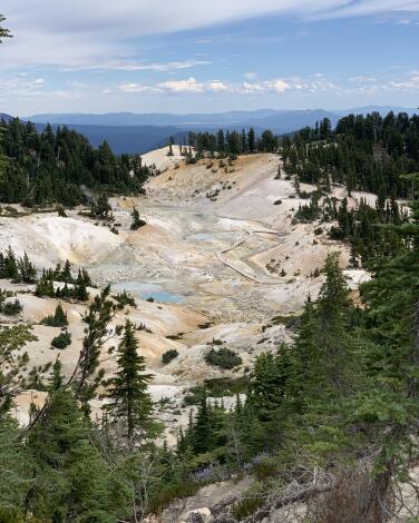
Behold geysers, hydrothermal springs and more at Lassen Volcanic National Park
Hike to Bumpass Hell, a basin full of hydrothermal features that you can explore on a boardwalk (once you get there via a three-mile trail). Bumpass Hell got its name from Kendall Bumpass who lost his leg in one of the boiling mud pots — a good reminder to stay on the trail. Another hydrothermal area, Sulphur Works, is accessible with just a short walk on a paved sidewalk.
In addition to boiling water and mud, you can hike to the top of a cinder-cone volcano in the park. It’s a four-mile round-trip hike, though it will feel longer since you will undoubtedly slide down with every step while ascending the sandy cone on the last half of the trail. The view from the summit is impressive, though, and those who still have energy left can also hike into the volcano itself from the top. For something less volcanic, there are two waterfall hikes: Mill Creek Falls and Kings Creek Falls.
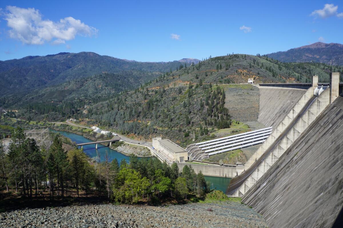
Learn about the legacy of the Shasta Dam
There is plenty of free parking and free guided tours are offered daily at 9 a.m., 11 a.m., 1 p.m. and 2 p.m. (weather permitting, as some afternoon tours have been canceled during days of extreme heat). The tour includes an elevator ride down to the base of the dam, unless the elevator is under maintenance. Tickets are released one hour before each tour, which is limited to 20 guests. Note that every guest must get tickets in person at the visitors center.
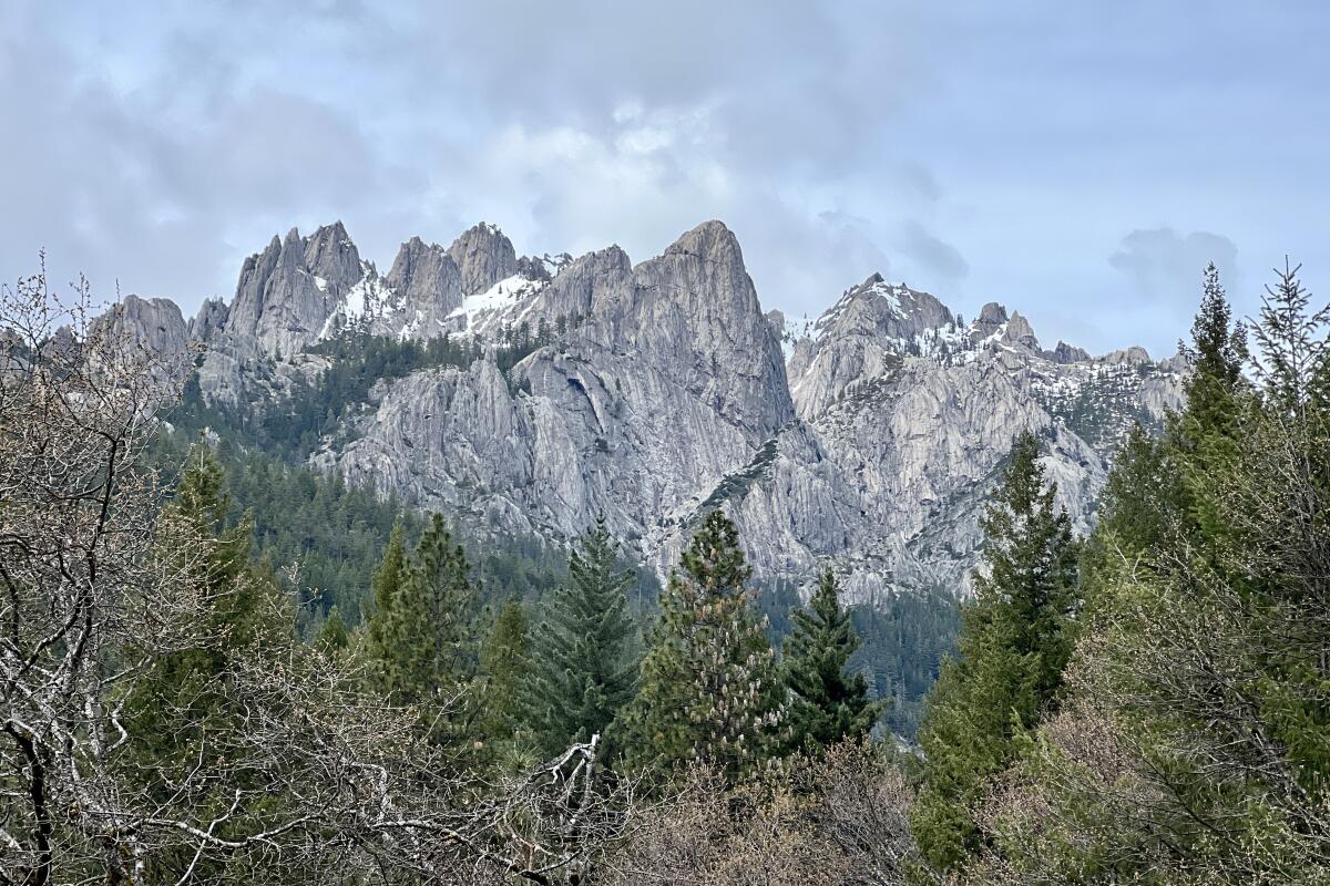
Marvel at towering granite rocks at Castle Crags State Park
The best place to view the crags is from Vista Point. Drive the winding four miles from the park entrance to the parking lot and walk the shady quarter-mile trail to the viewing point. Accessible from the same parking lot as Vista Point is the Crags Trail to Castle Dome, which is the only hiking trail that leads up to the crags themselves. The trail is 2.8 miles each way, but with an over 2,000-feet elevation gain in that short distance, it’s rather strenuous.
Aside from the namesake rock formation, the state park also offers 28 miles of hiking trails, rock climbing routes, and catch-and-release trout fishing in Castle Creek and Sacramento River.
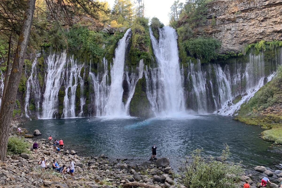
Hear the roar and feel the spritz of Burney Falls
A short distance from the parking area, there’s a paved walkway that gives a good view of the waterfalls from the top. Normally, visitors can also hike the trail down to the base of the waterfall and even dip in the pool below, but that is not possible this year.
In the past few years the waterfall has become extremely popular, with more than 250,000 visitors a year. Many visitors walking off the path have caused the trails to erode. The trail to the base of the waterfall is currently closed for reconstruction, but in the meantime, visitors can view the waterfall from the top. Construction is also underway on Highway 89, which leads to the park, so expect slower traffic when heading here.

Explore vibrant murals in downtown Redding
There are currently over two dozen murals in total, and Viva Downtown Redding provides a handy map for a self-guided walking tour, highlighting 18 of them. The mural walk is a great way to explore downtown and see what it has to offer, from the Art Deco Cascade Theatre, the Art Hunger gallery and the various vintage and antique stores.

Find a new appreciation for airport food at Peter Chu’s Skyroom
The large menu includes the usual suspects — chicken chow mein, walnut prawns, beef with broccoli — and then some. More unexpected specialties are the Hunan-style lamb stir fry and Peking duck (which requires a four-hour advance notice to prepare). If you’re lucky enough to get one of the tables by the window, it comes with a view of the runway.
At dinnertime there can be an hour wait for a table, so if you do have a plane to catch, be sure to allocate some extra time.

Try an award-winning cup of coffee at Theory Coffee Roasters
Theory Coffee now has two locations in Redding (along with another in Mount Shasta), where you can get pour-overs of its single-origin coffees, properly made cortados and seasonal lattes. Both locations also carry baked goods and sandwiches from Eden Bakery nearby so you can grab a quick breakfast before heading off on your adventure of the day.

Grab a Numb Numb Juice at Fall River Brewing
The brewery started in John and Amanda Hutchings’ garage in 2011 then graduated to an operation near Burney Falls. The duo then opened a taphouse in Redding in 2013 and eventually moved their entire operation to the city five years later.
You can get Fall River beers at the brewery, the taphouse in the Hilltop neighborhood and at many local restaurants and bars. For an easy entry, try the Blood Knot, a hazy IPA infused with blood orange juice.
Sign up for The Wild
We’ll help you find the best places to hike, bike and run, as well as the perfect silent spots for meditation and yoga.
You may occasionally receive promotional content from the Los Angeles Times.


